
"Hiking is like flogging yourself" - Stewie, 5.4.2018
It was time. Time to test everything we have learned during the past year of traveling and camping. And hiking.
This time we would not be bringing our newly acquired Target duvet or pillows to fight the cold. This time we would not be kneeling down to cook our morning oats.
Both of us would be wearing our matching (yes, matching, but only by accident) hiking pants that have seen it all from New Zealand to Guatemalan highlands and to Colombian mountain ranges. Richie’s walking sticks were up for a true test - would the other one finally break? Would he fall into mud in slow-motion when the sticks would fail him? (Almost but more of that later.)
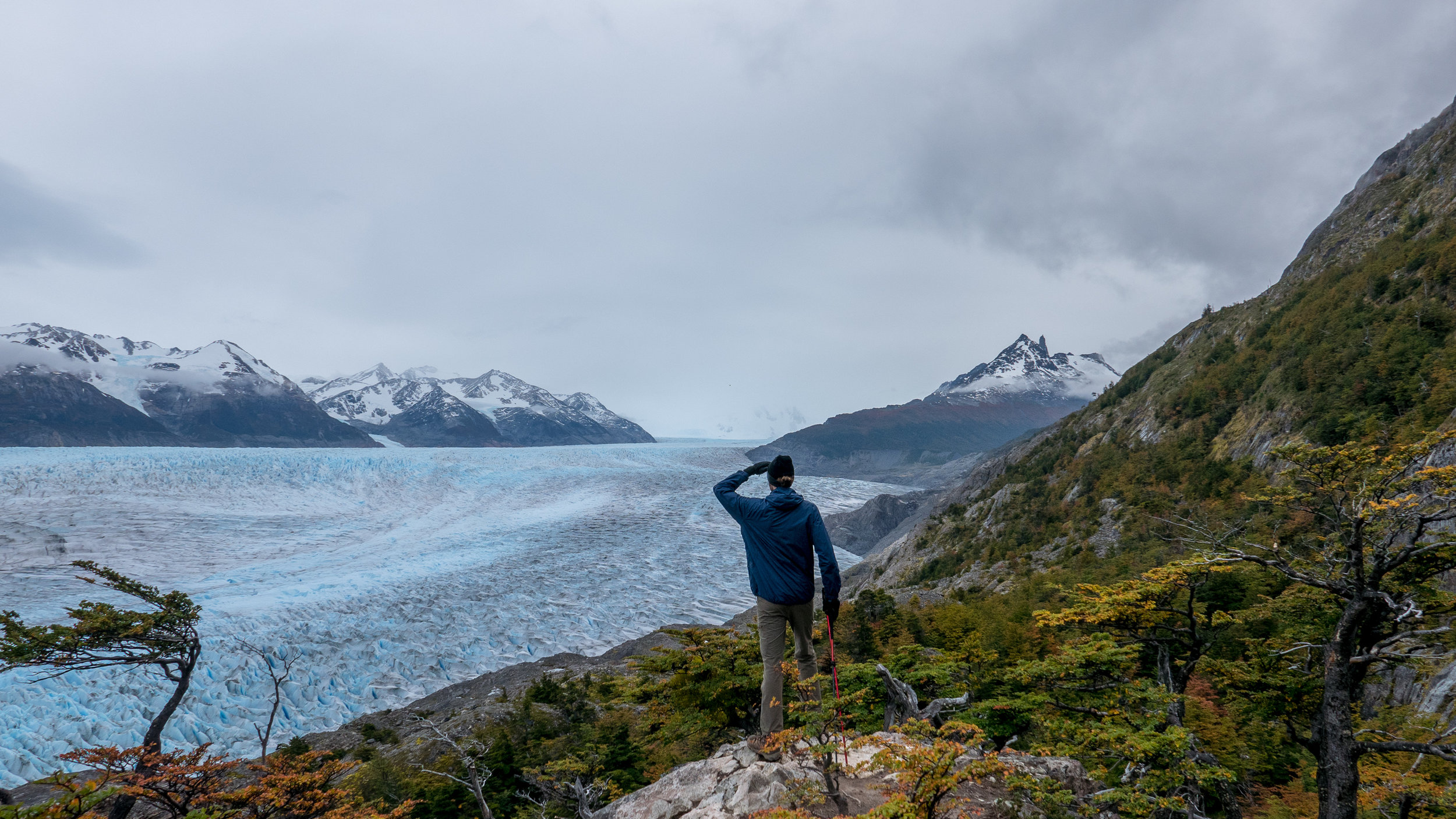
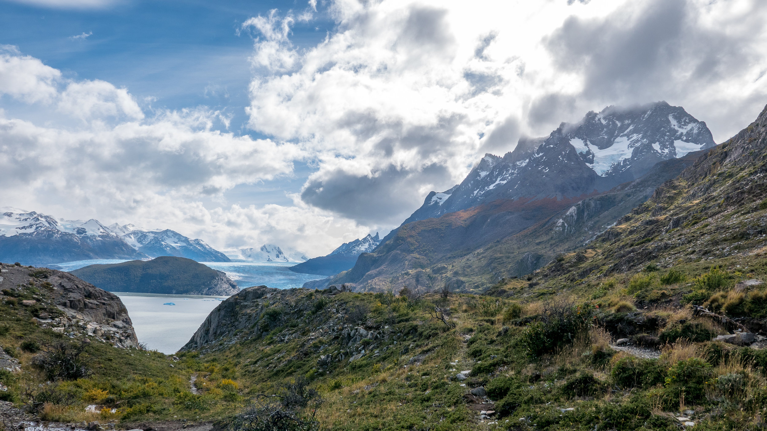
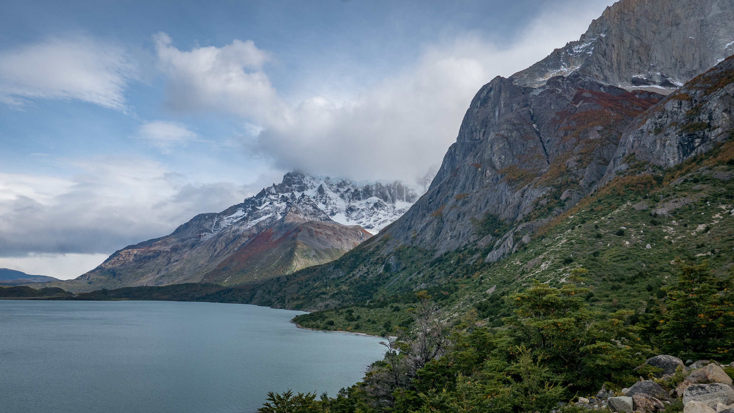
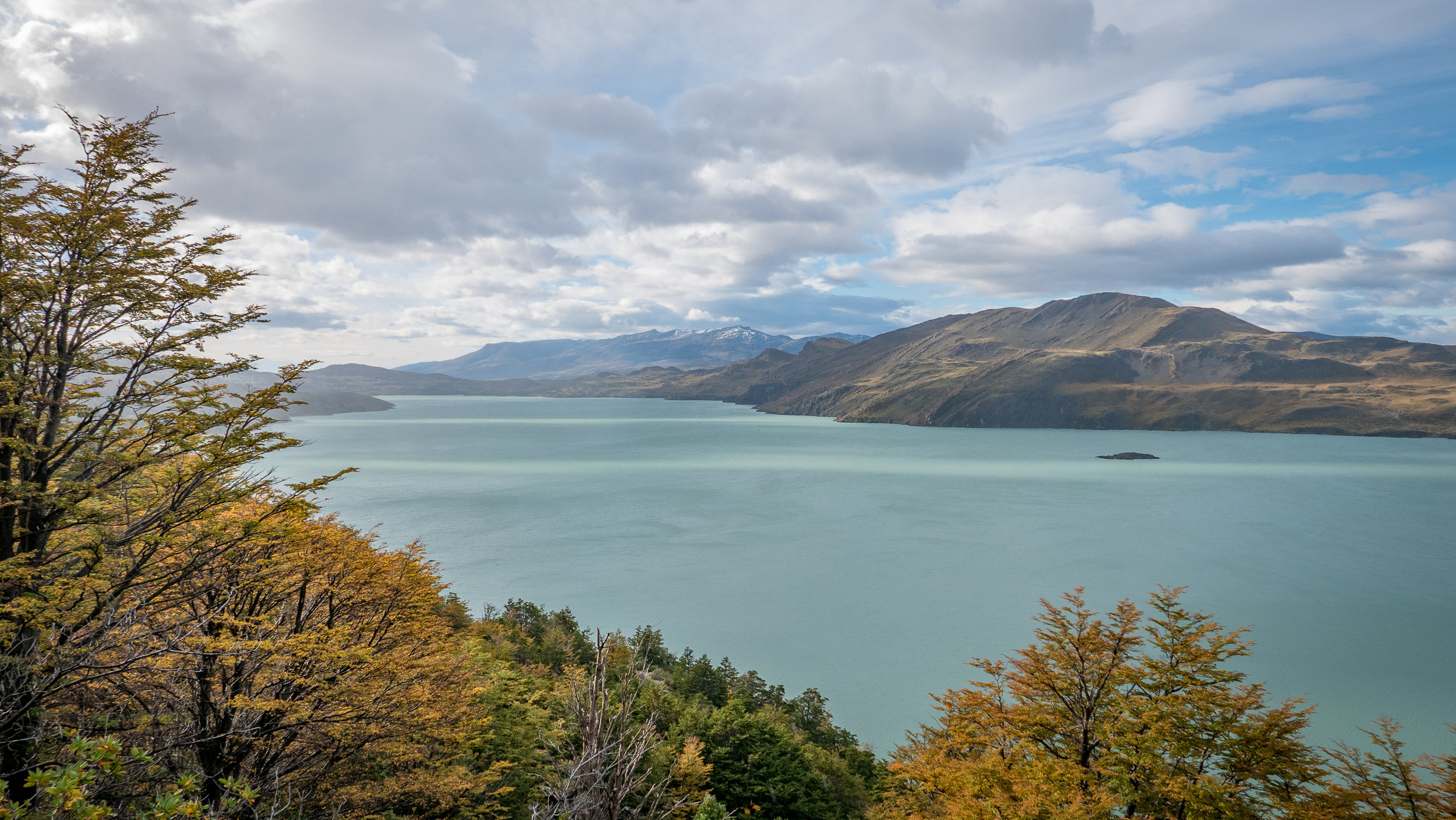
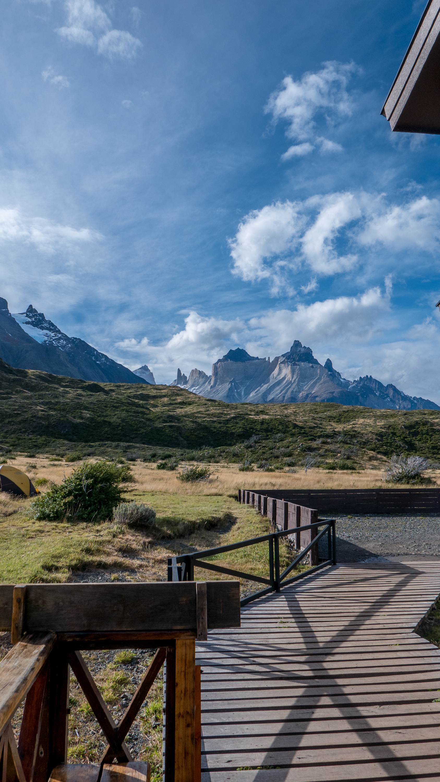
Patagonia so far had been a beautiful, albeit a bit chilly, and a very, very expensive stint. Hiking to Mt. Fitzroy in El Chalten is by far the best and most beautiful hike we have ever done. It was going to be hard to top that one but Torres Del Paine national park in Chile would try its best.


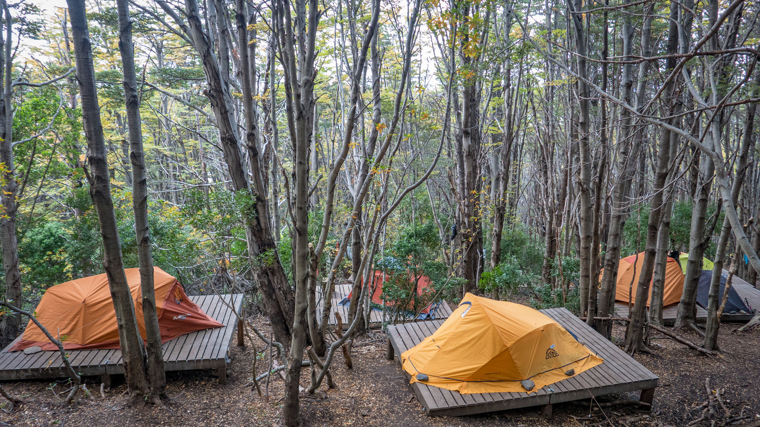
Torres Del Paine is quite a popular place. By “quite” I mean thousands of tourists walking the trails every year and the park sure knows how to do business. You could pick your lodgings from sleeping in your own tent to a tent that is waiting for you there, or sleeping inside the refugios on a bed (bed $30 USD, if you want to add sheets it’s another $30 USD!) to luxury accommodations.
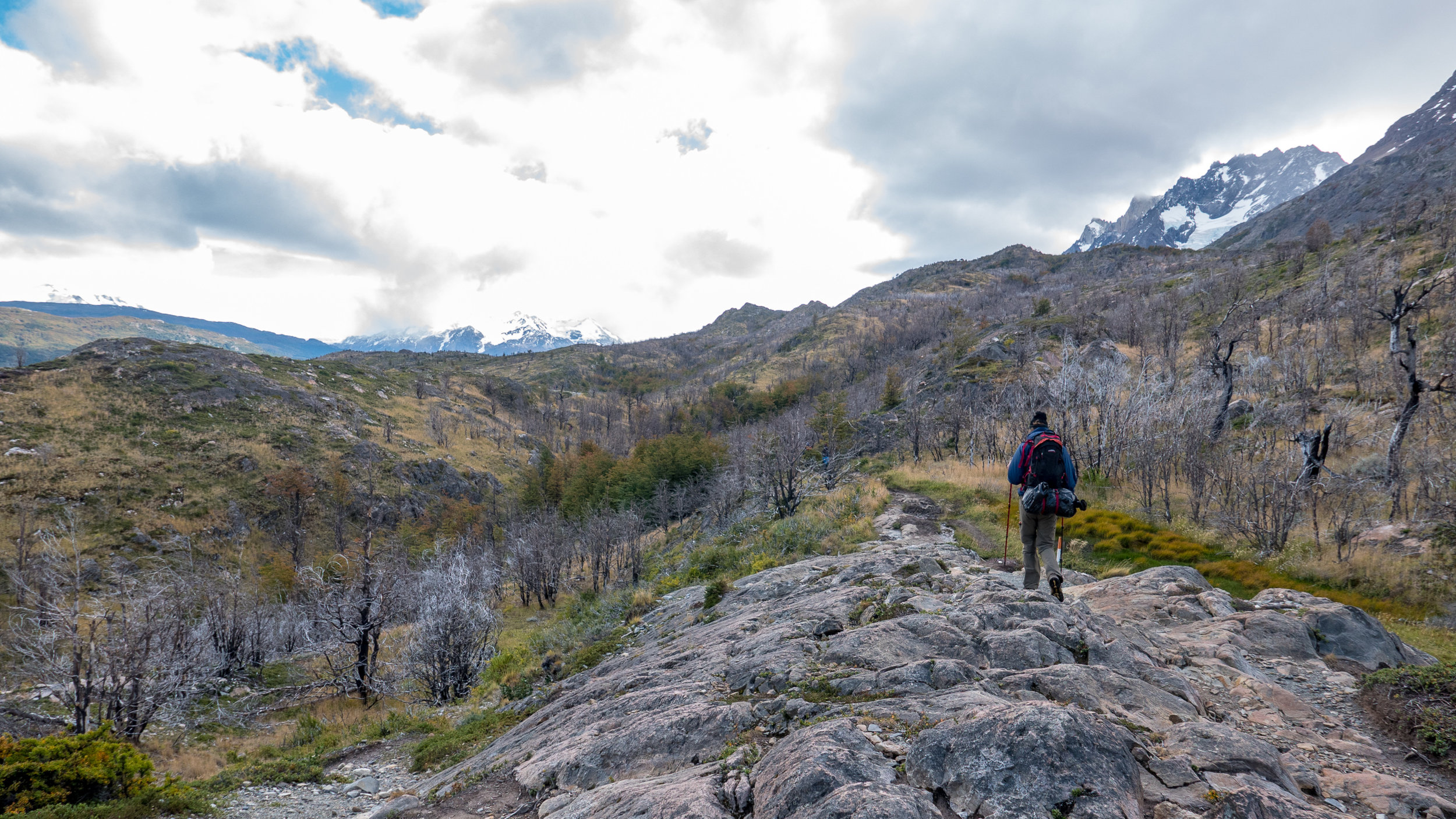
You can choose to do day-hikes, the W-Circuit (4-5 days) or the full O-circuit (7-8 days, although some moutain goat we met was doing it in 4). Luckily I wasn’t having one of my moments where I think we can do anything, I mean anything, and didn’t try to talk Richie into doing the O. The W-Circuit with 5 days would be quite enough for us.
Of course we’d be doing it the cheap way which means carrying your tent, food and cooking equipment. You want to know how much the cheapest way cost us?
$560 USD for five days.
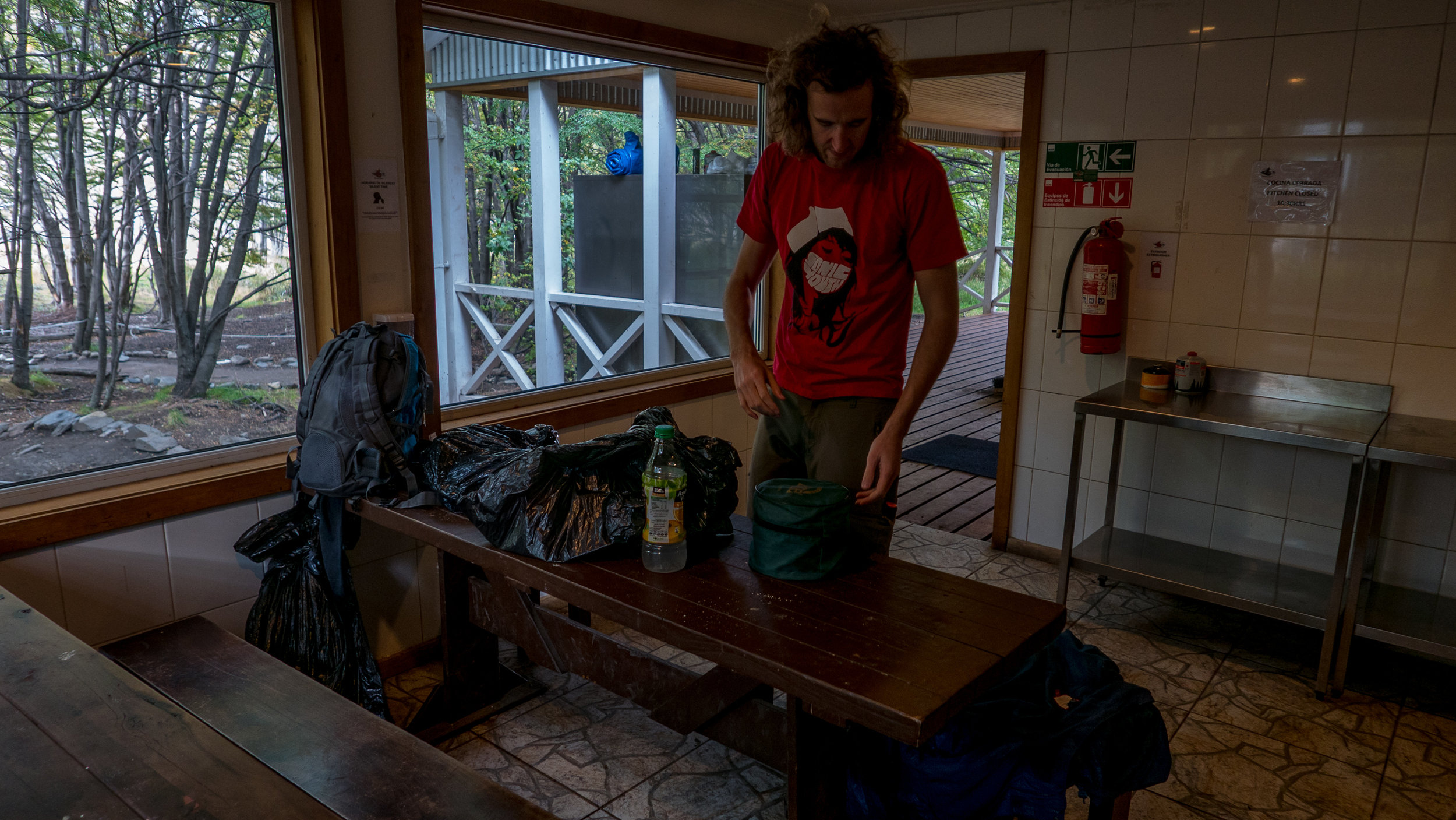
As I said they know how to do business. Just pitching your tent on the first two camping sites cost $8 USD each and $16 USD each at the last two stops. Add renting the gear, getting to the park and back by bus and catching a 30 minute catamaran for $30 USD each. And buying a lot of nuts and stuff to make your own trailmix. We are still eating that trailmix a week after finishing the hike.
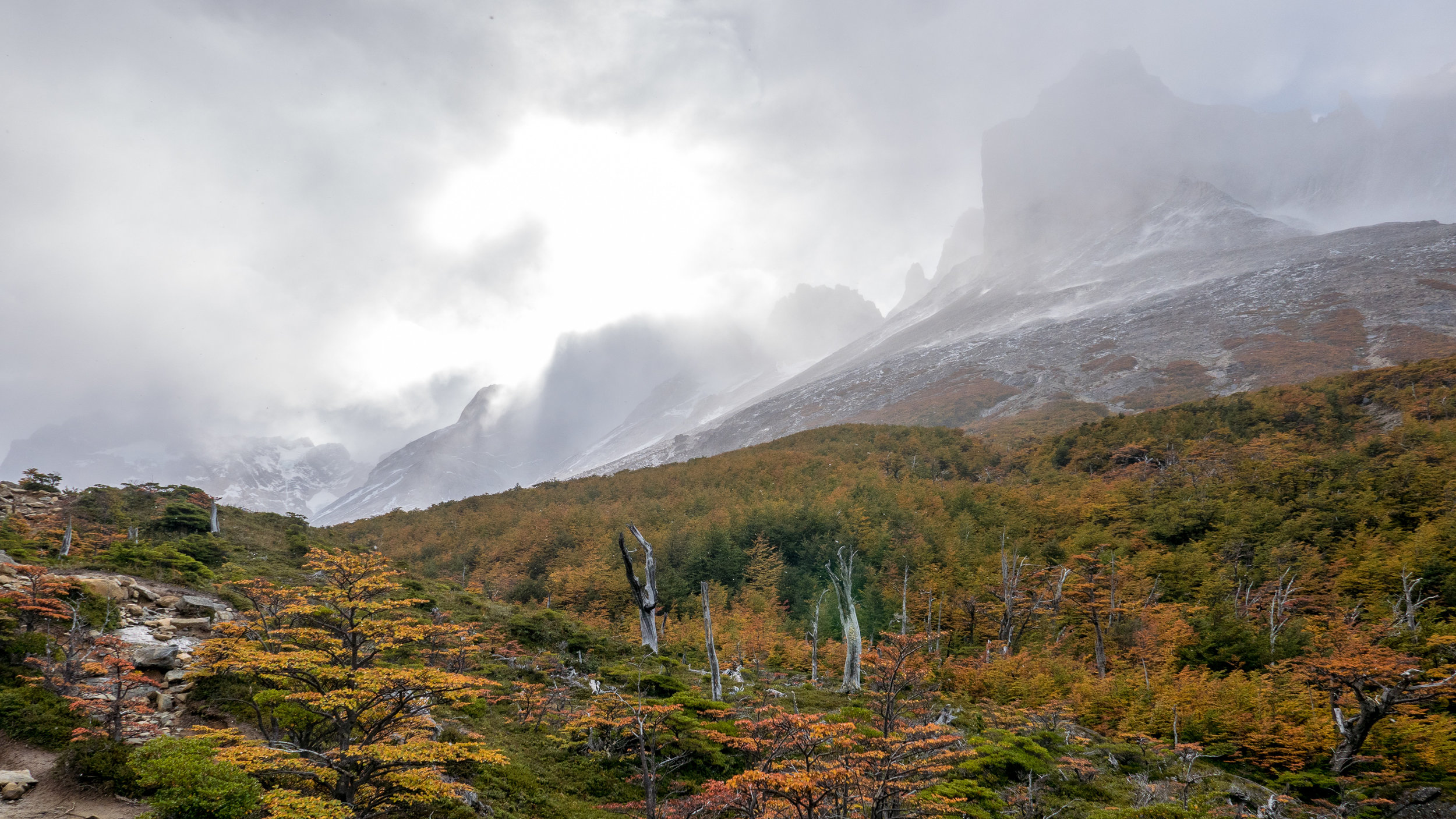
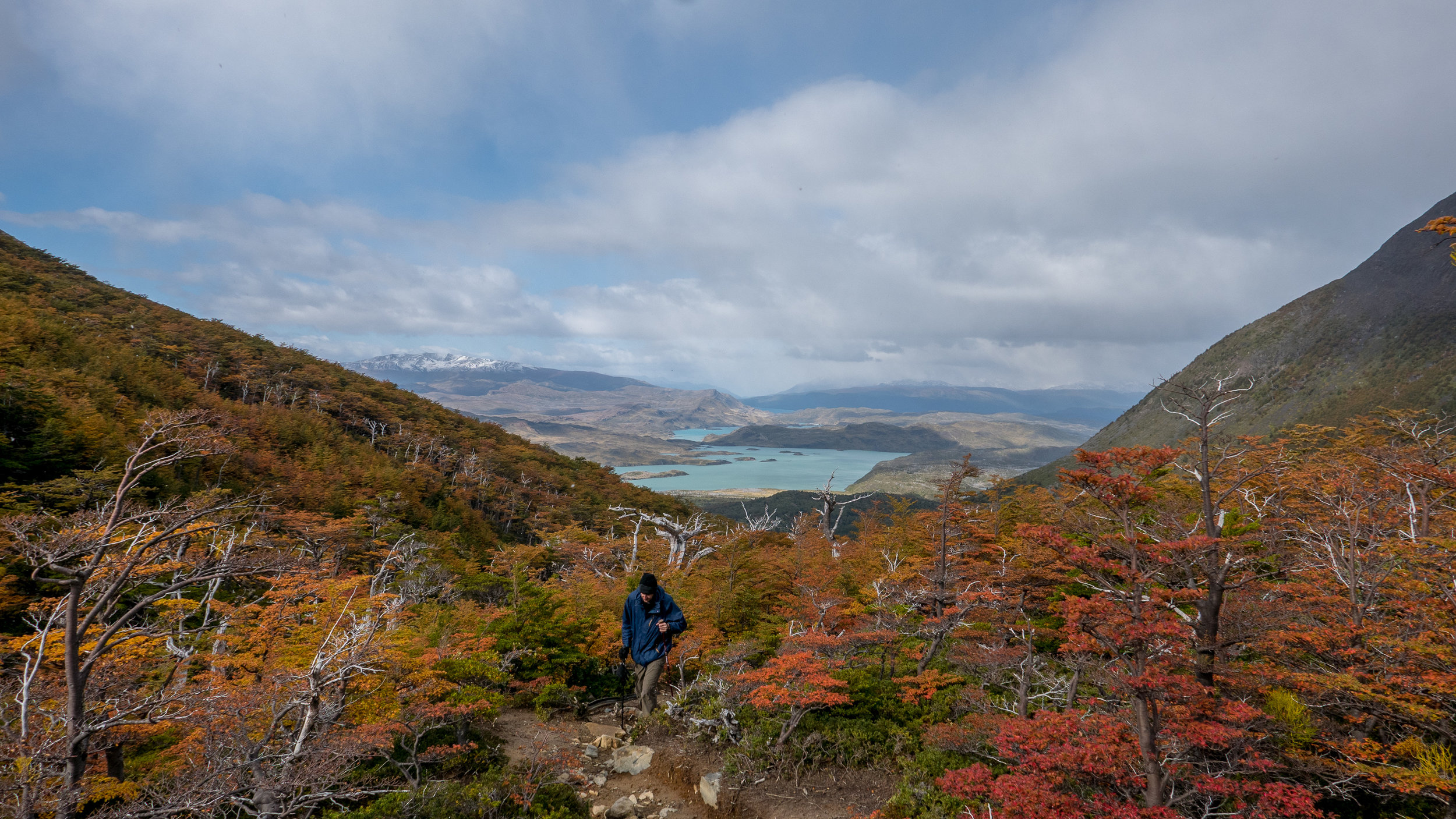
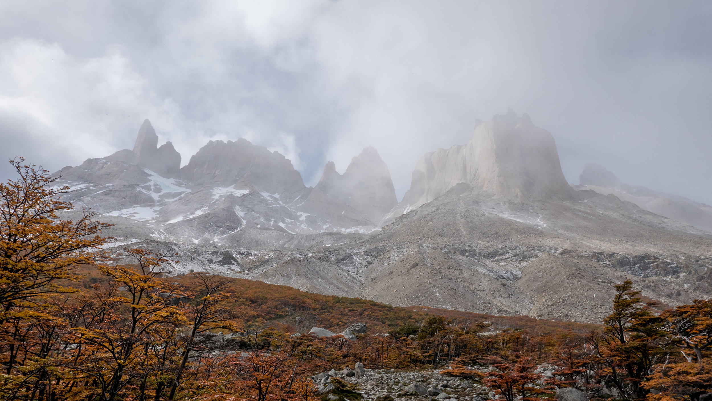
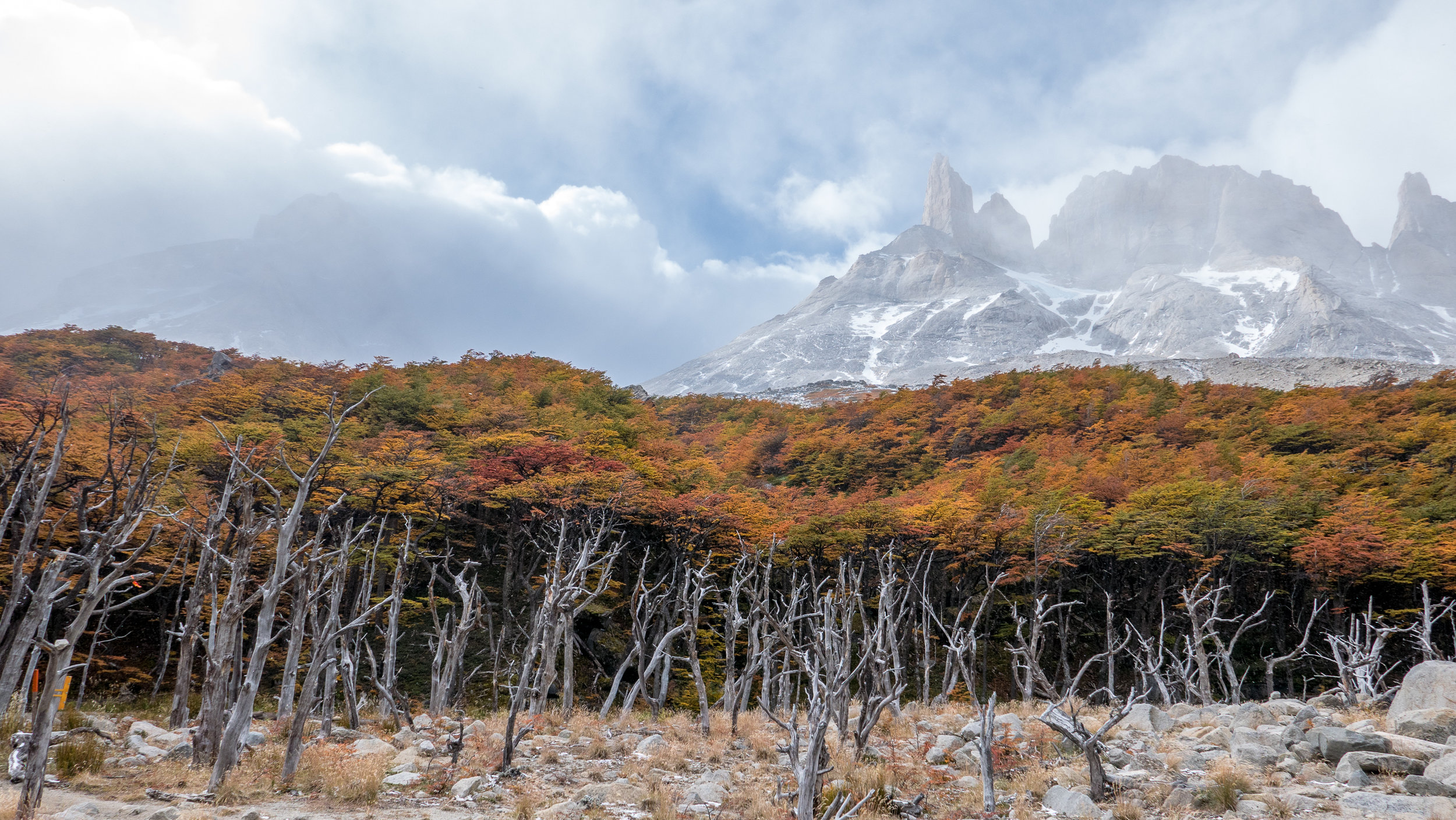
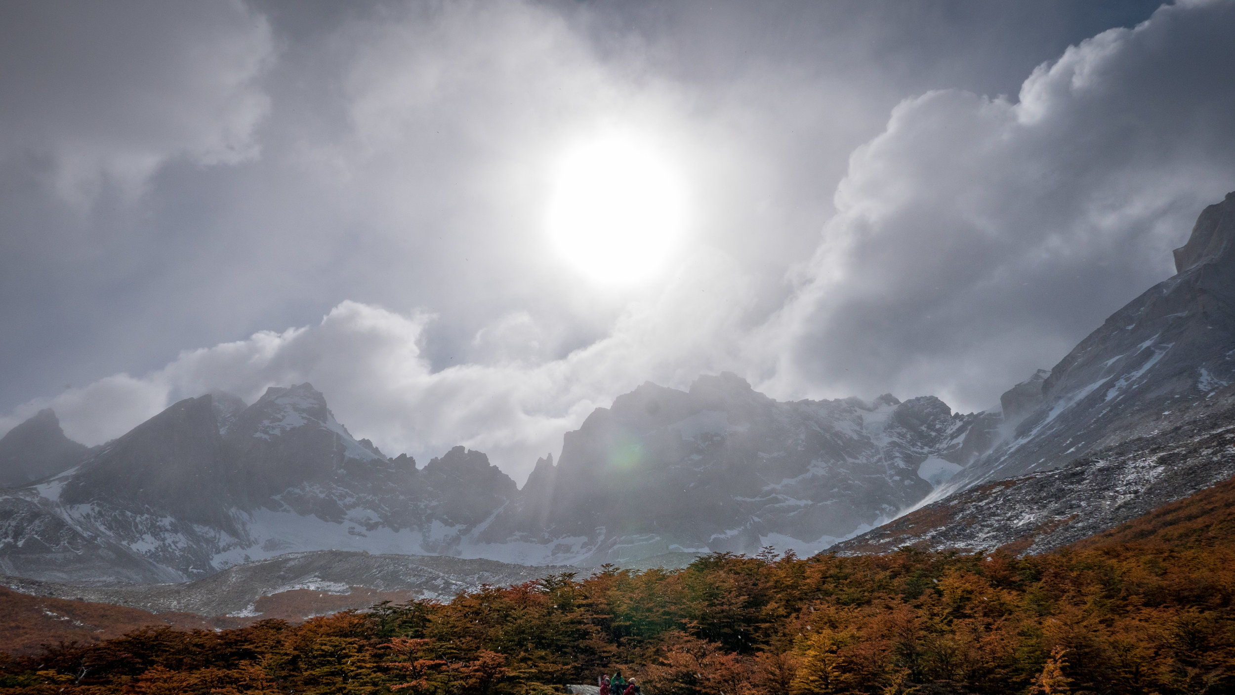
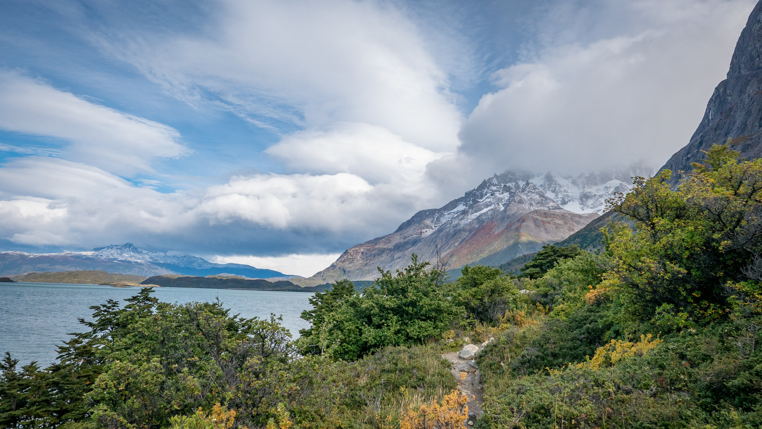
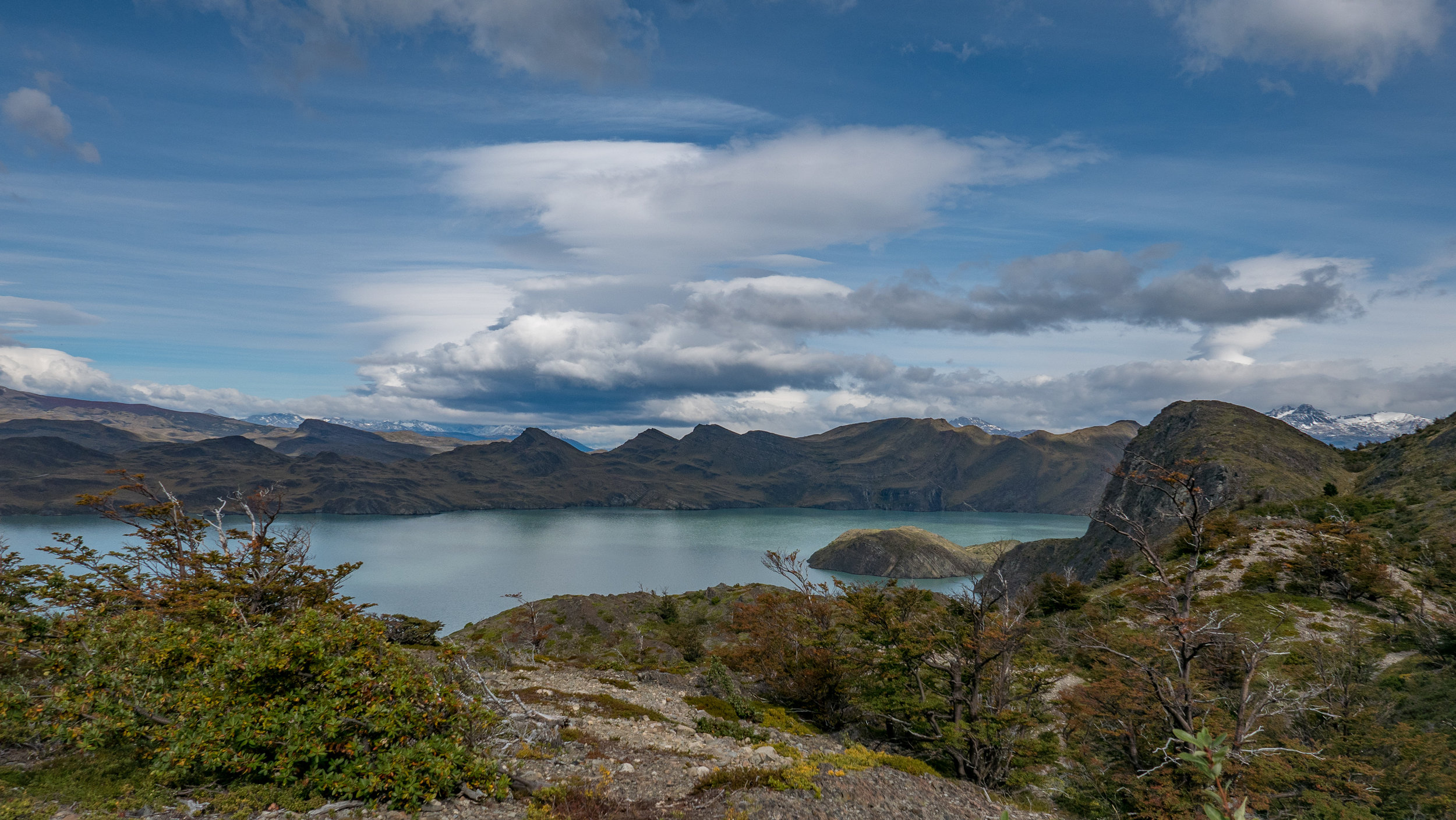
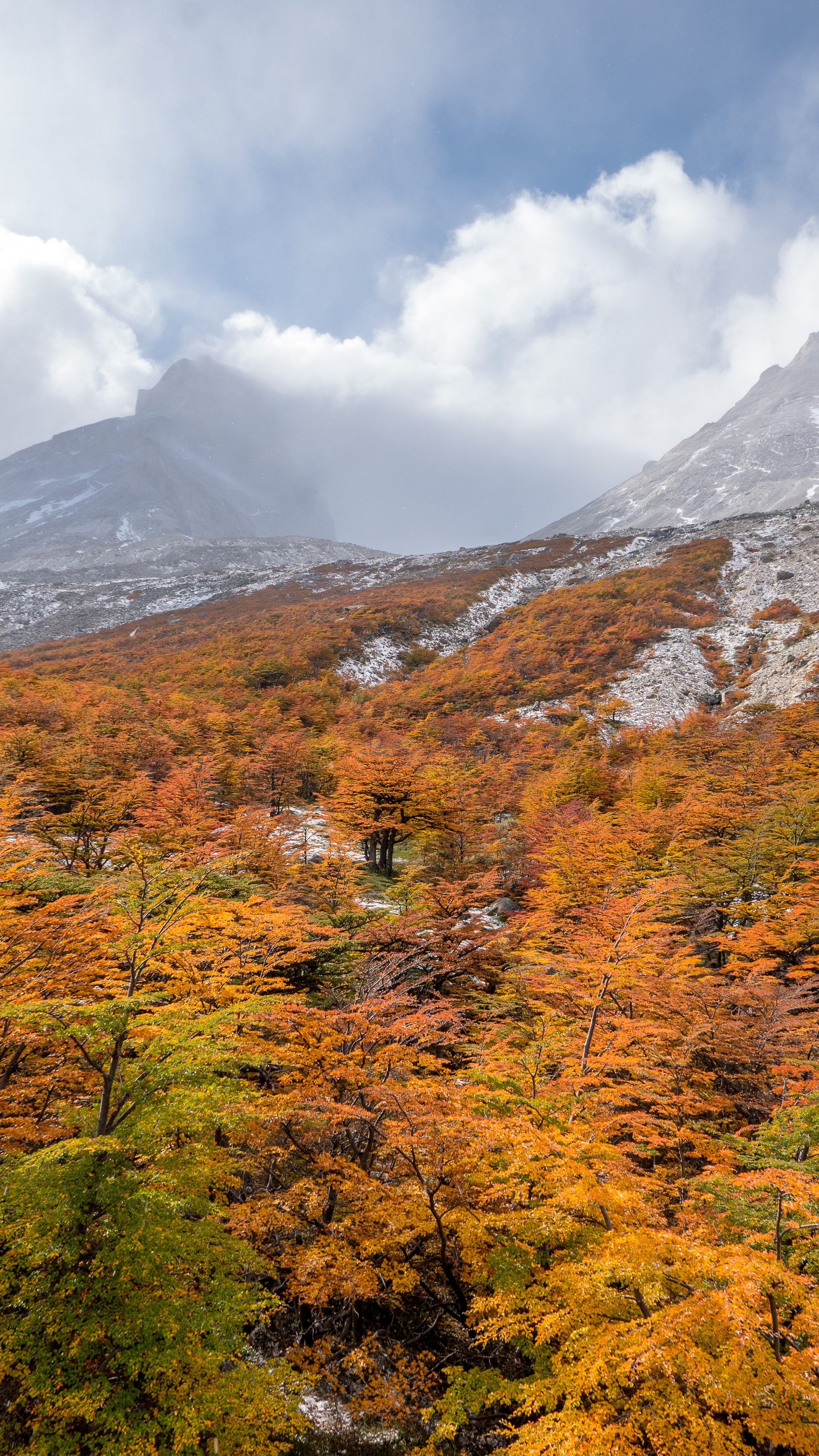
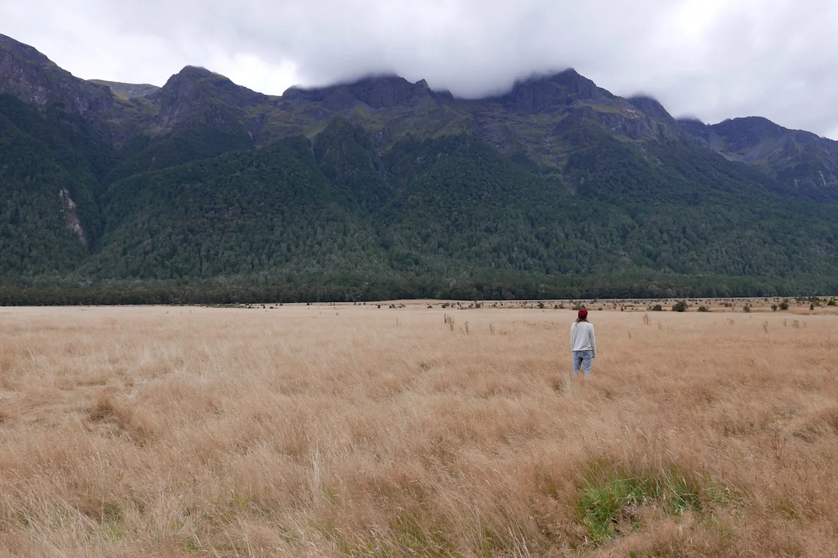
Most popular time to visit Torres Del Paine is during the summer months. April is definitely the shoulder season as it is getting colder. But also it means less people and awesome autumn colors! And a giant -15 degrees celcius sleeping bag you have to carry on your back for five days. The weather forecast really loomed over us, promising rain and/or snow for every day with lovely temperatures ranging from -7 to +4 celcius degrees. Can’t wait!
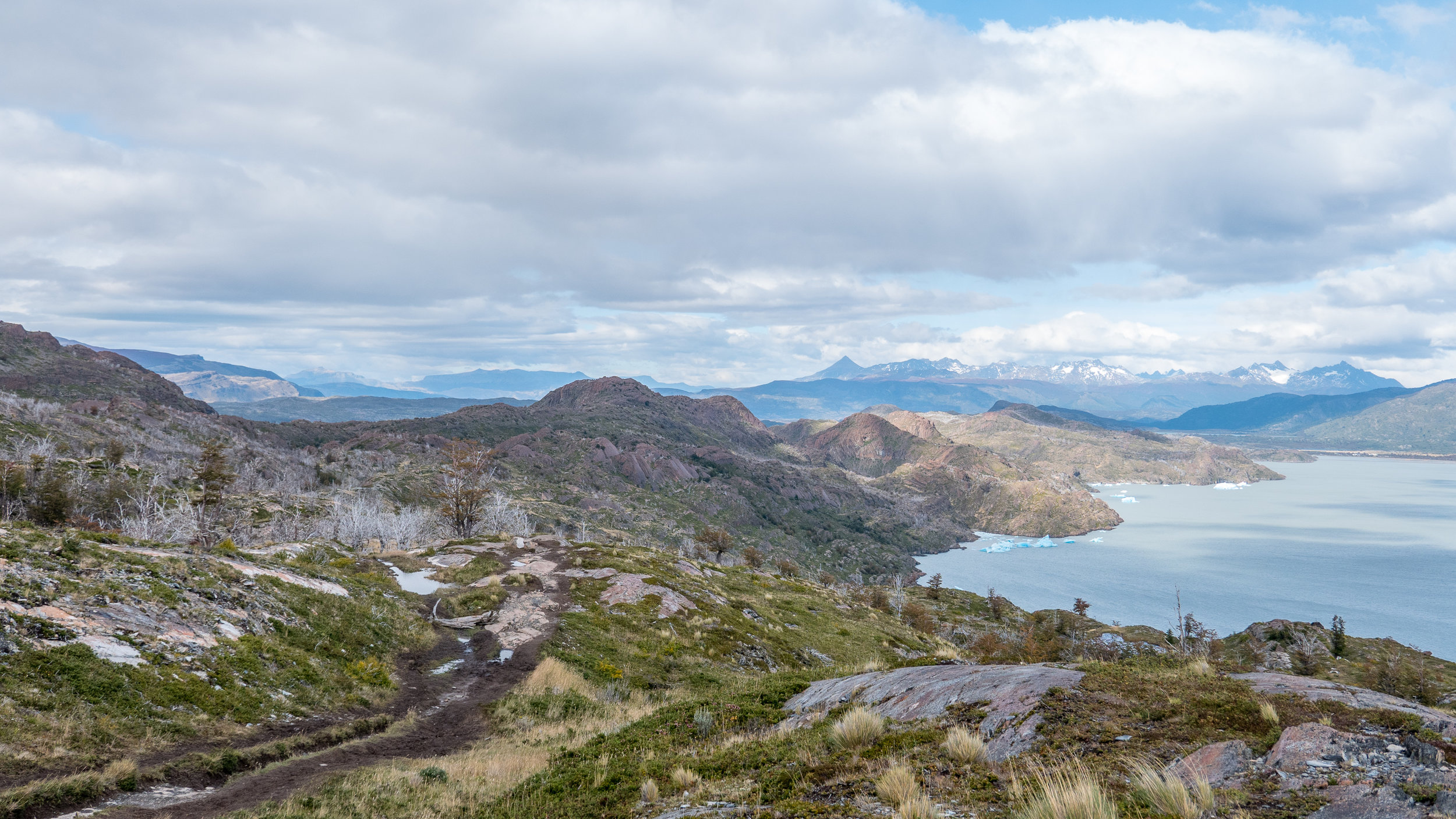
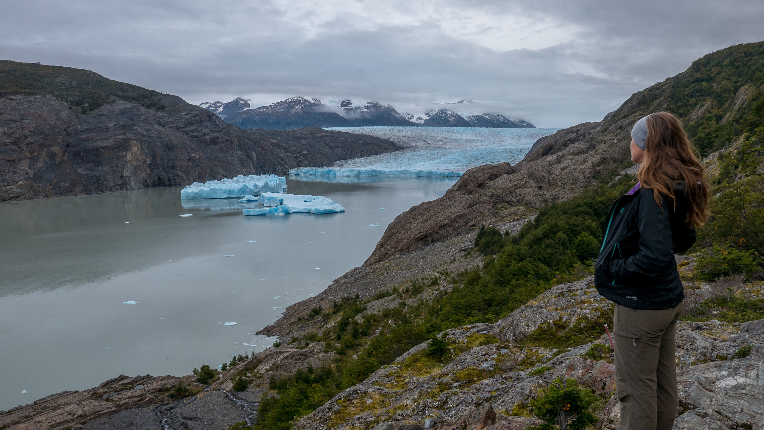
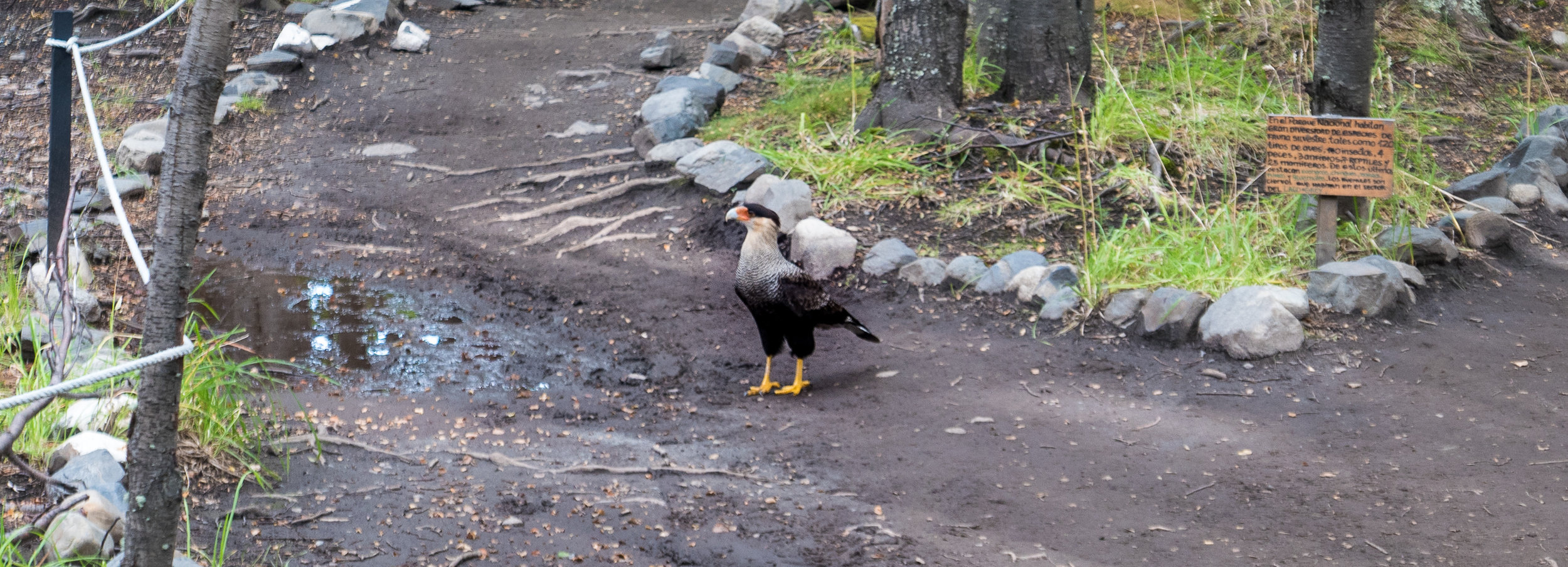
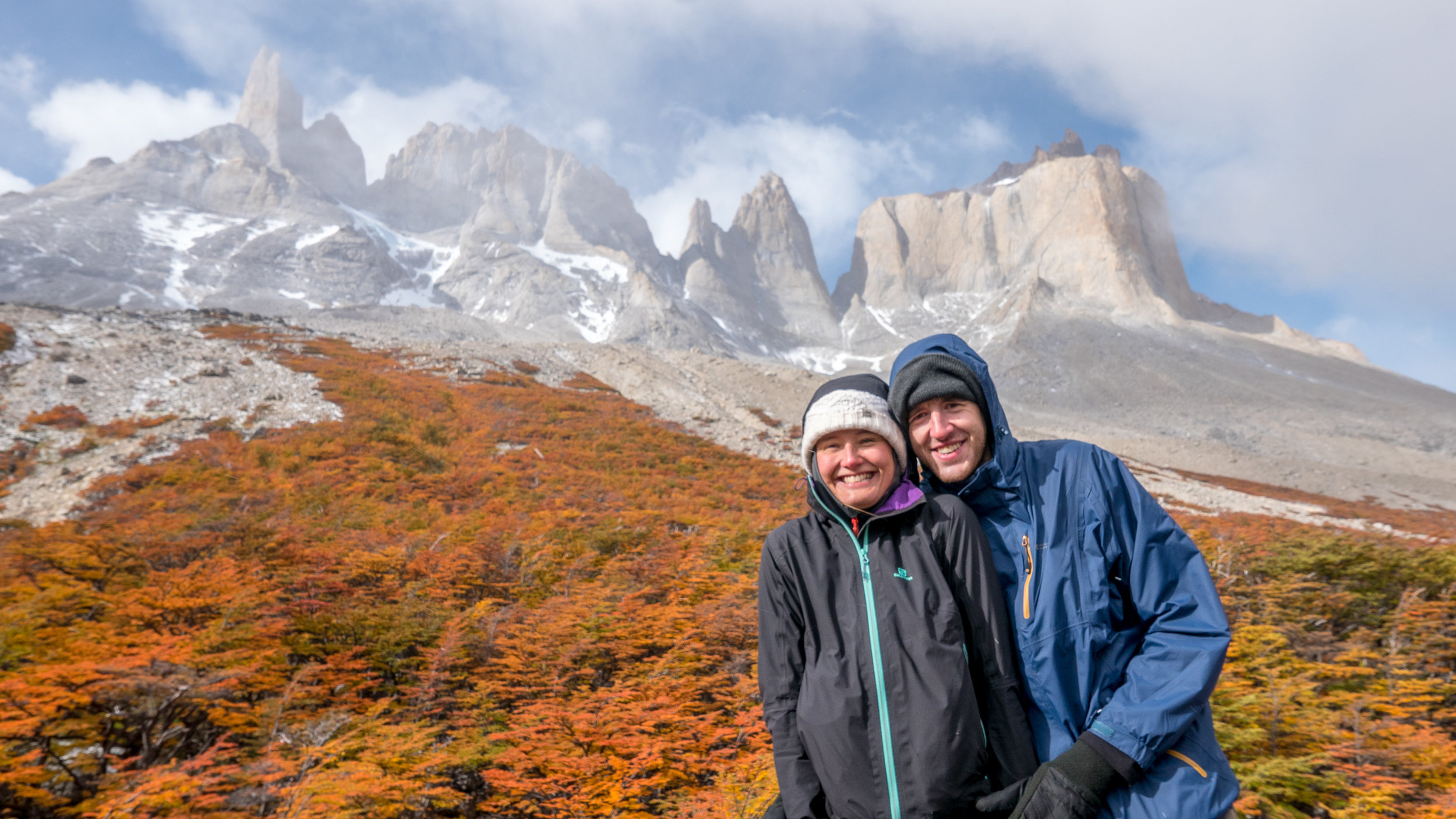
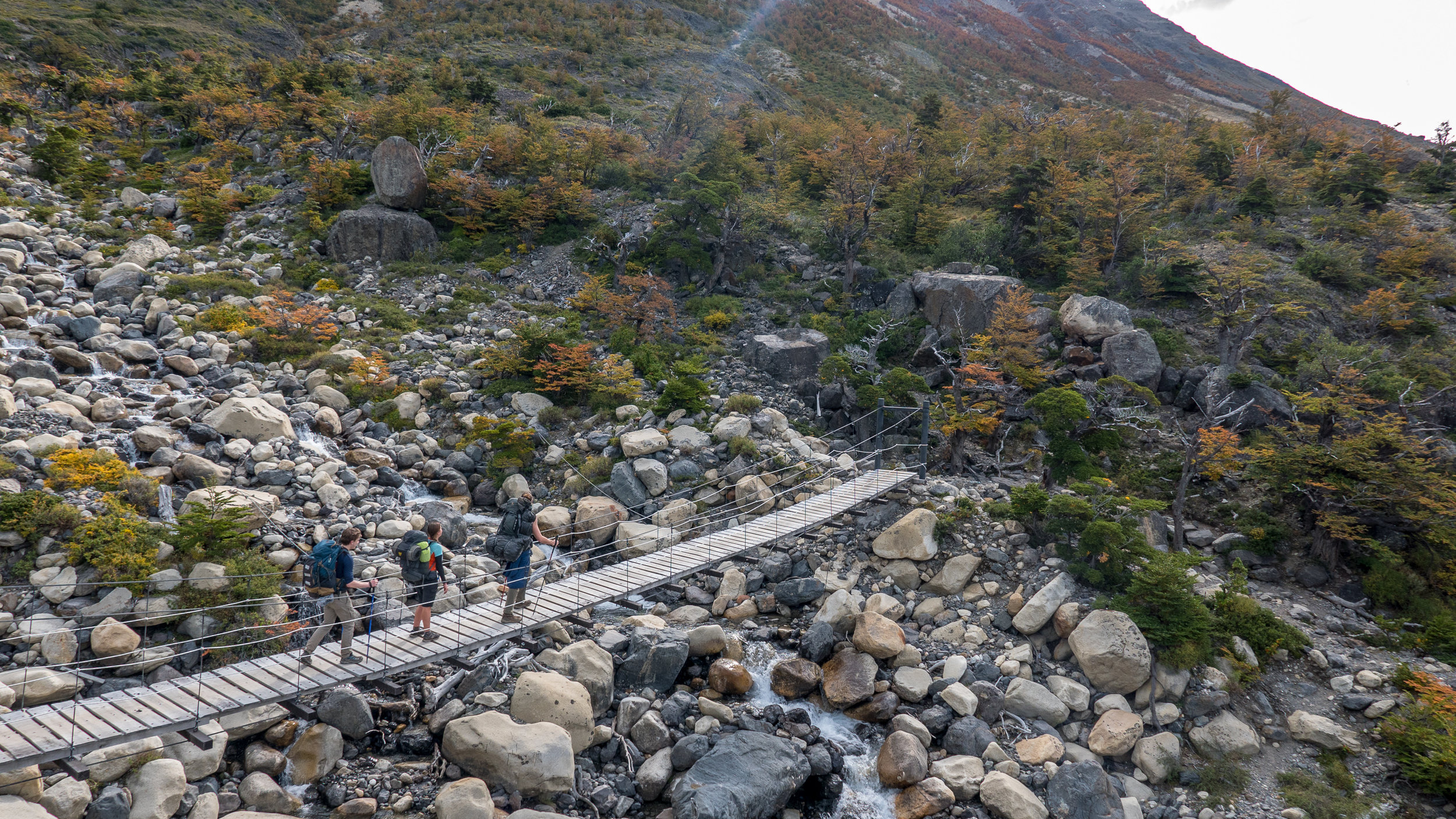
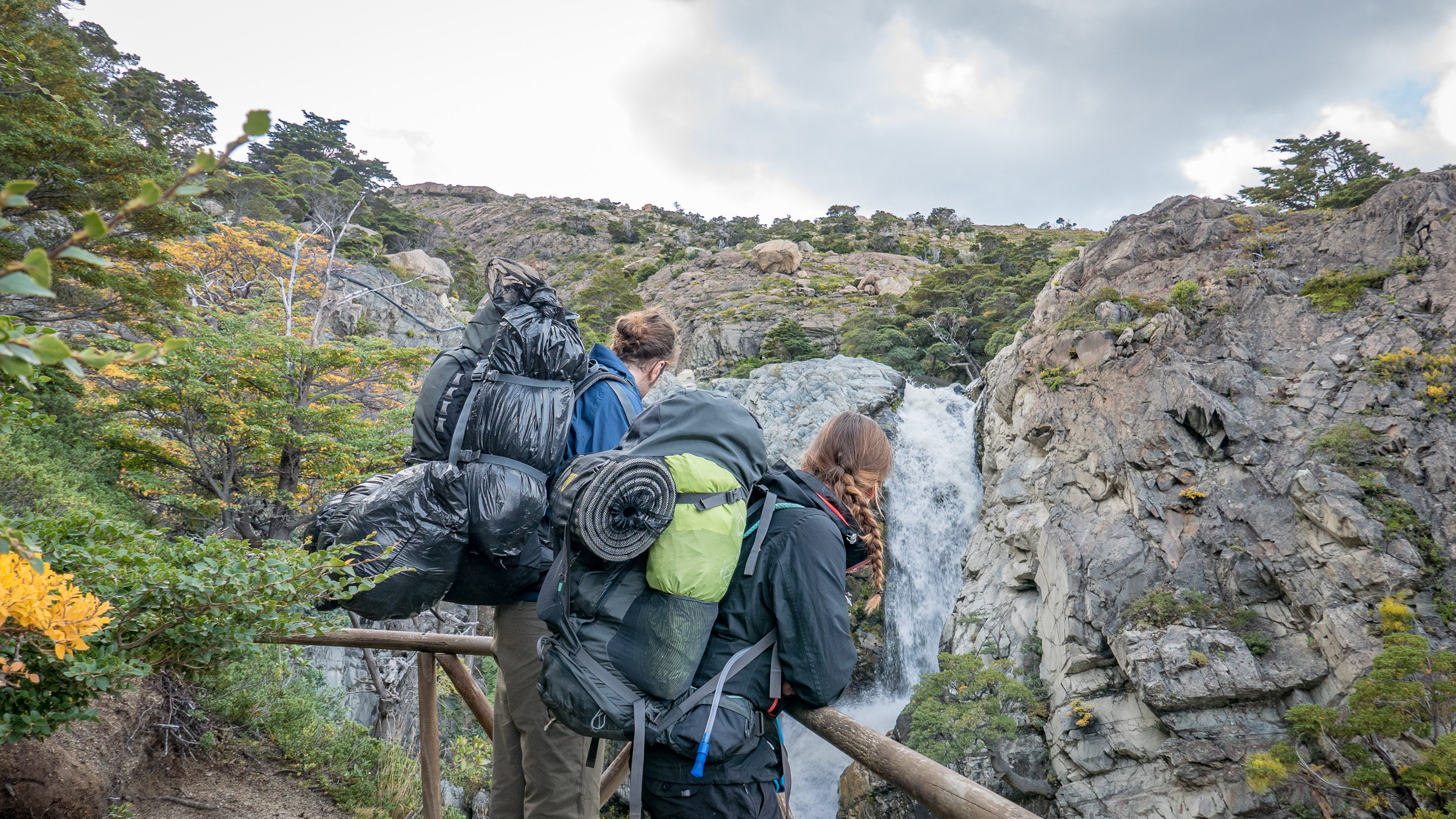
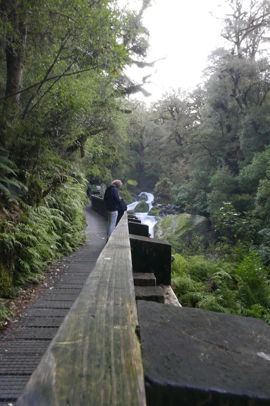
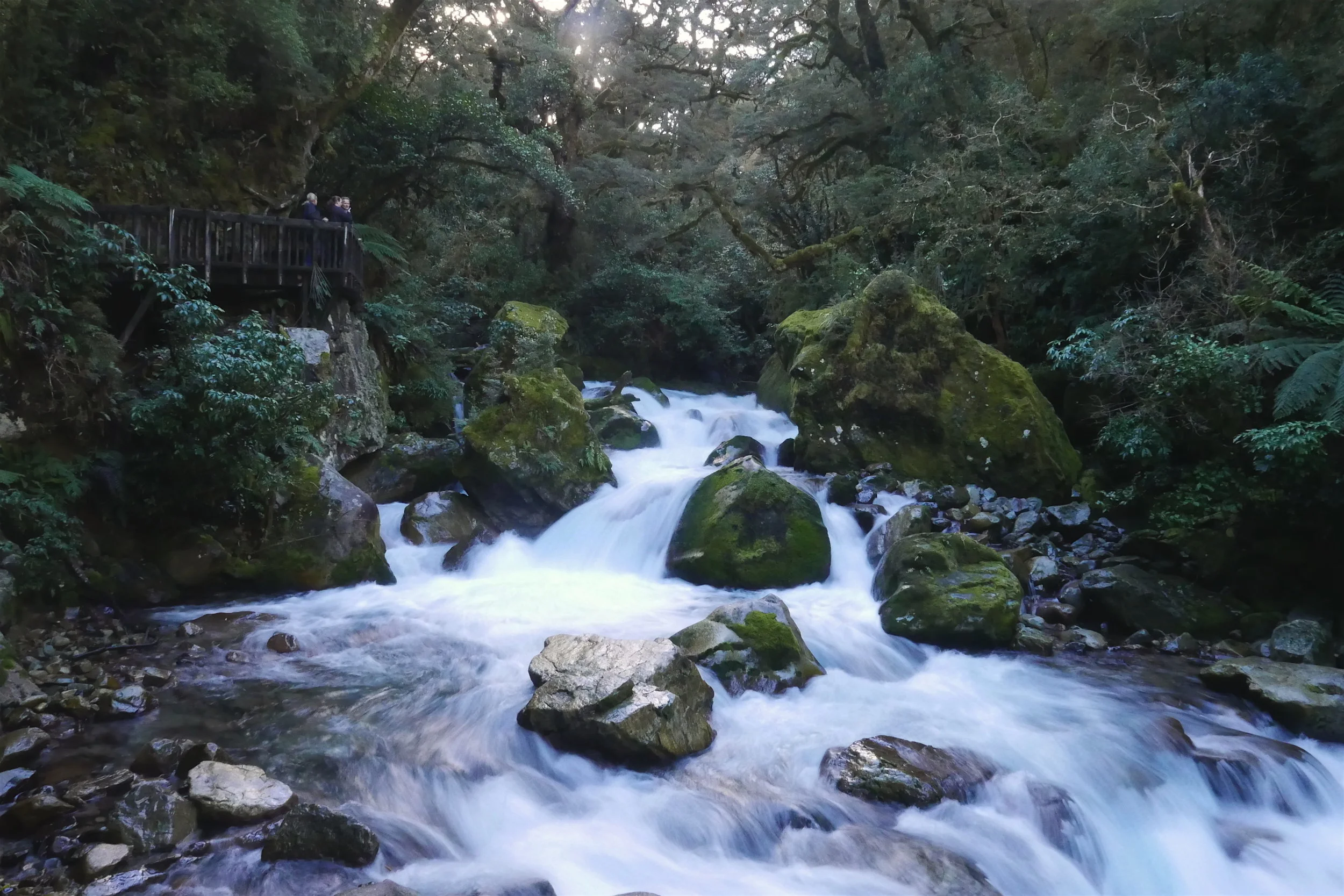
During the five days we visited countless lookout points, got seriously bored of eating nuts for lunch every day, got to experience the true Patagonian weather with horizontal rain that maked us soaking wet (but only on our left side), laughed, witnessed pro-hikers throw bad looks and pitiful comments to people who they think have never camped before, threw someone’s food away as it was hanging from a tree where we wanted to pitch our tent (amateur campers…), battled a challenging swamp that almost claimed Richie and half-claimed our friend Stewie, swore never ever to hike again, and made it to the Torres lookout just when the clouds went away for couple of seconds! You might think hiking is a solitary thing but it was actually quite the social experience since you see the same people every day and this ended up being one of the most fun things we have done thanks to the company.
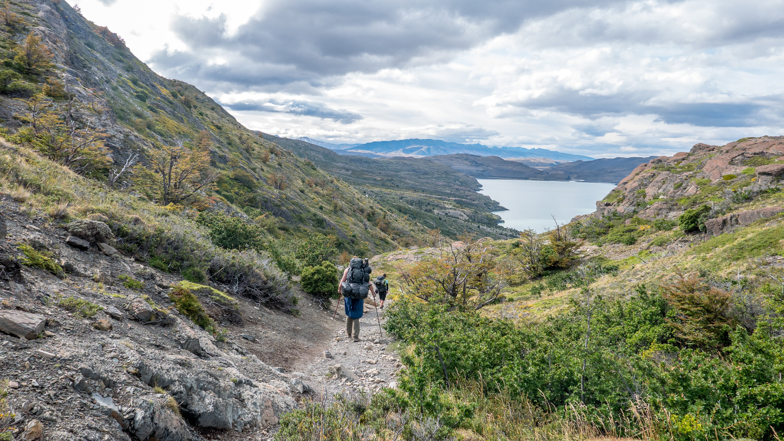
We are not quite sure how much we walked at the end because apparently no-one at the parks deparment knows how to count. Each map displayed different distances and even the markers on the trail were telling vastly different stories on how long it would take to get somewhere. I counted 76km, maps.me says 96km. I’ll take the latter as we can round it up to hundred and that’s something!
We can sum up the experience with Stewie’s words from the fourth day: “Hiking is like flogging yourself.” It sucks but afterwards you feel kinda good. You’ll never do it again until you have forgotten the pain the last time caused you. It’s been a week now and I find myself thinking about the mountains in Peru. Maybe once more…

How much can you spend on chocolate?
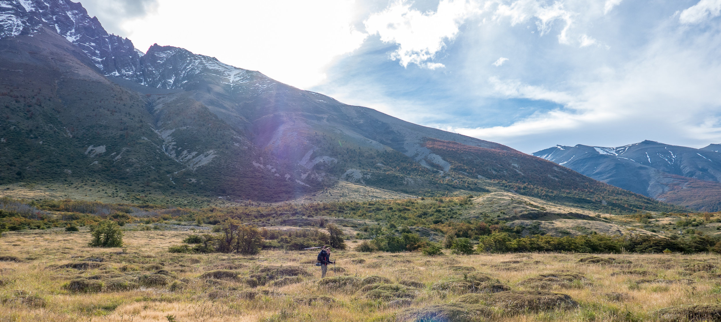
Hikey days were ahead of us. Better to forget partying in Buenos Aires or playing the waiting game at Peninsula Valdes. Now it was time to get active again and for Richie to dust those (walking) hiking sticks as we started to wander deeper into the legendary outdoor opportunities of Patagonia.
If you have ever looked at Argentina on the map you probably know it is huge. I do not know what had happened to my geography knowledge when I uttered the words “it’s kinda like Finland”. Yeah, times four.
Thus we embarked to another 20 hour bus to get to the Switzerland of Argentina - Bariloche! We had been spoiled by our first longhaul bus from Iguazu Falls to Buenos Aires that included blanket, pillow, and a proper dinner with wine. The wine was quite shite as the Irish would put it but it was the type we like - free - so of course we finished the tiny bottles. The buses to Puerto Madryn and now to Bariloche were disappointments after that, you had to bring your sleeping bag inside to get some cover from the blasting AC and prepare your own foods in order to avoid starving.


Bariloche looks like a little mountain village in the Alps or at least tries hard. And as a good Switzerland- wannabe, they offer chocolate on each corner and each shop between the corners. Not thinking about the fact that we were already about $1,200 over budget, I happily spent exactly $52 USD on chocolate during seven days. Breaking my own chocolate eating records here.

Sad thing about recording every expense on Splitwise-app is that you can't escape the facts about your spending habits
Bariloche is about chocolate, microbreweries, hiking, snow activities and lakes. Exactly seven lakes. One of the most popular activities is to rent a car and drive the route of the seven lakes, stopping on each “mirador” (viewpoint) to look at these aformentioned lakes.
Can I tell a secret? They all look pretty much the same.
Also we discovered an Argentinian recipe for how to construct a mirador:
1) Find the spot for the most beautiful views towards the lake
2) Now move about 100m -200m to the left or same to the right and find a spot with tall trees and bushes
3) Voilá, you have a mirador!

Nice views right?
It was challenging to peek through the obstacles at some places to get a glimpse of that blue water reservoir but then we just ditched the car and walked to the better unmarked places.

The hiker-thief


All that driving for a full day made us (me) grave for a day out walking. Bariloche is not short of hikes and one could do amazing multi-day treks over the mountains. The refugio (hut) - network is good and it’s free to spend the night there. The only problem can be the fast-changing weather, all the walks in the National Park were closed on the day we arrived due to high winds and falling trees.
Out of the two hikes we did, Refugio Frey was a perfect one, not only because of the clear blue sky weather we got. There’s two ways to reach the hut; the adventurous way of scrambling on rocks and over mountain tops or through peaceful strolling in the woods with a moderate climb at the end. Adventorous one was the one I wanted to do but to begin it you need to take a skiing chairlift up (or add extra 4 hours of walking - no thanks). And guess what they charge for this chairlift?
$25 USD. One ticket. One person. One way.
No thanks.
Easy forest-route then.


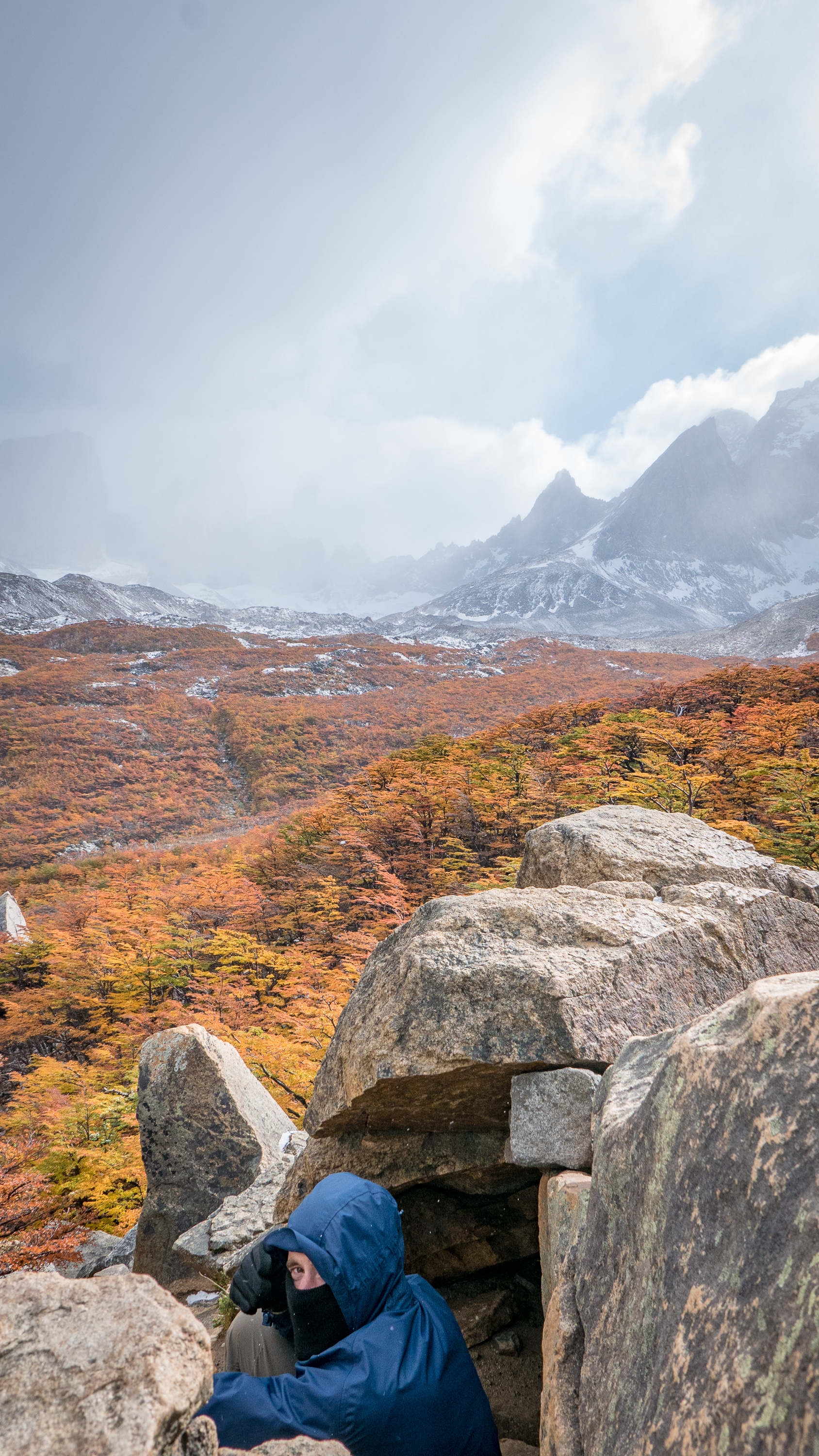
At the top we encountered some seventy army men and we learned they were there for the yearly climbing training. Apparently the area around Refugio Frey is bursting with routes and during summer time you have a hundred people pitching their tent around the premises. I have to say I’ve become more and more happy about our timing in Patagonia. Even now when it’s the shoulder season (fall), there are a lot of people everywhere - in hostels, trails, viewpoints.. I can’t even think how crowded it is during summer time!


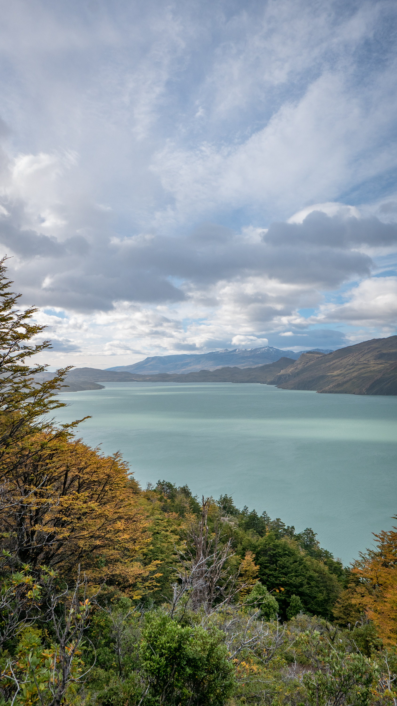
Look at that view!

I can think of only one more thing worth mentioning of; we ate spaghetti bolognese for dinner seven days in a row. Welcome to budget-traveling.

Torilla tavataan! (Let’s meet at the town square, preferably a Finnish one)
How to hike El Cocuy National Park in Colombia. Published February 2018.
It happened. I achieved something great. It wasn’t the Forbes “30 under 30” that I daydreamt about when I was a fresh graduate and still full of career related goals nor winning the world championship in snowboarding. “30 under 30”-list shows new irritatingly fresh faces every year and if I would have ever gotten more serious in snowboarding I would most likely have been badly hurt, multiple times, by now.
So I am happy with my current great feat.
If you have ever read any travel articles about Colombia, you’ll recognise the clichés “Colombia has it all”, “Many faces of Colombia” etc. what it is trying to tell you is that Colombia has a) beaches, b) cities and c) mountains.
After being on the gringo trail for a while and getting our adrenaline fix in San Gil (rafting was fun, paragliding was not! I am not a bird clearly), we headed to the snowy mountains of Sierra Nevada del Cocuy Chita. I used Pinterest for the first time for planning our travels in Colombia and photos of weird plants lured me to embark us for 15hrs+ bus rides to a less travelled corner of Colombia. And yes you read right, photos lured me, Richie usually does not have an idea where we are going before we are actually going there. And I think he would have used his veto rights if I would’ve revealed the reason for this trip to be weird mountain cactuses.

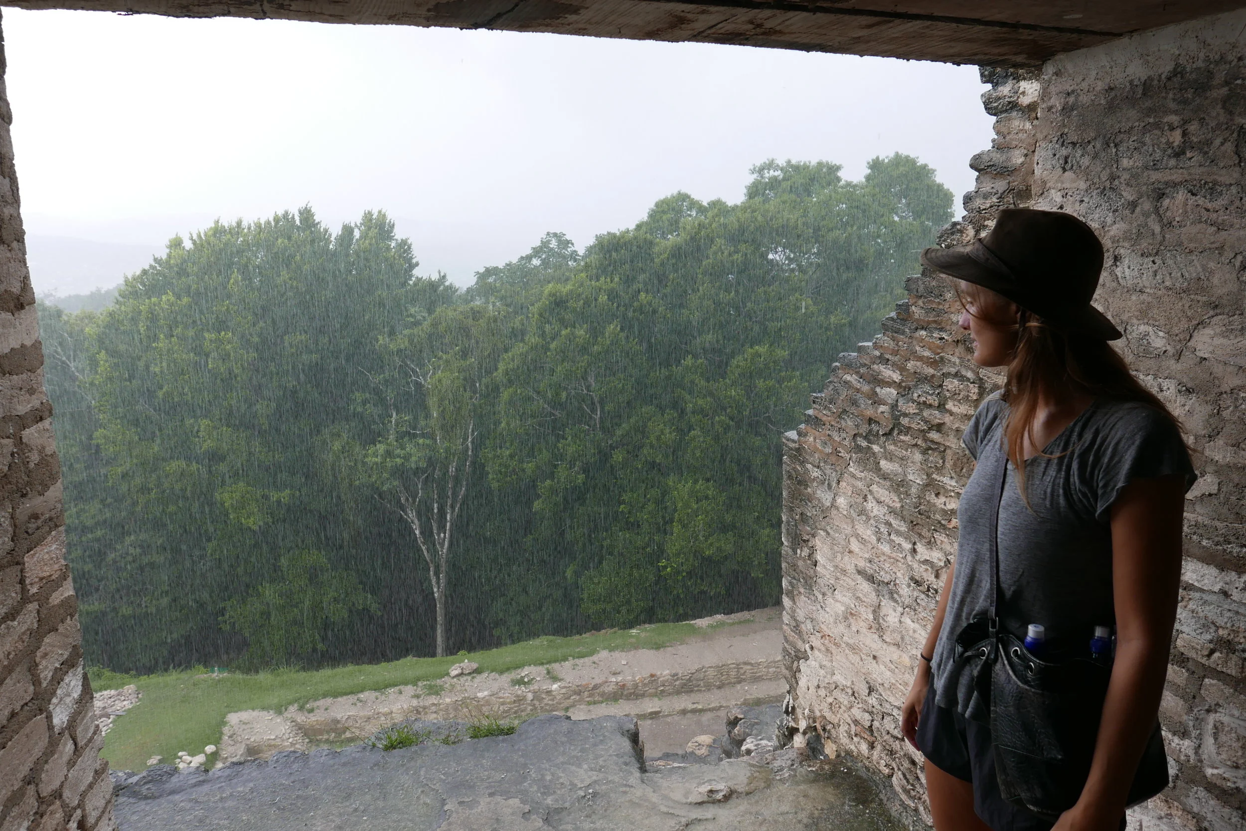
El Cocuy national park is a massive area covering valleys, glaciers and snowy mountain tops. The villages where you start your hike booking are located at over 2,500 meters above sea level, the accommodation in the start of the trails at 3,600 meters, and trails themselves can go up to 5,000 meters.
Back in the days – when even New York Times made an article about hiking in El Cocuy – one was able to go without a guide, do an epic 6-day trek, and walk on the snow.

Now however things are different. The park was closed for 1,5 years because of conflicts between the government and the indigenous people. Or something else, depends what sources you read or who you talk to. The park finally opened in 2017 and now one can choose from three different one-day hikes and has to hire a guide for 120,000 COP. “A guide” in this case means a local person going up with you, there’s really no guiding services in terms of history, geology etc. included. After hearing the background - about the park closing - and how it affected the income of local families we just said “fair enough” and paid happily the $40 USD.

Because of the closing and basically a pause in any tourism development, the process of getting to El Cocuy and booking the hikes is a bit of a messy affair but a great chance to practise ones Spanish. Since I am not writing a travel blog to provide guidance for others I will skip a lot of the practical matters but you get an idea how difficult it is to do a one day hike here:


1) First you need a guide name. You can pick one from a list in the park office and just call different ones, try to manage to understand their Spanish and if it’s a yes or no and hope for the best that you both got the day right. Other option is to call at the cabins that offer accommodation in the start of the trails and pick one of their guides. Easier this way.
2) You need to go buy insurance for your guide. Different office from the park office, of course.
3) Go back to the park office to register yourself and the hike(s) you are doing. Pay entrance fee.
4) Get yourself up to the cabins. Options: Milk truck (10,000 COP) or private transportations for 15,000-40,000 COP pp depending on your luck and how many other people are going. We took the milk truck and that was a fun experience albeit a cold one!
5) Have the park ranger check your permits and paper work
6) Hike!
7) Find your way back to the El Cocuy/Guican town. Again, an alternative option (cheap option) was to take the 5am school bus with the local kids.
8) End your journey with 3+ buses and 12+ hrs back to big cities.

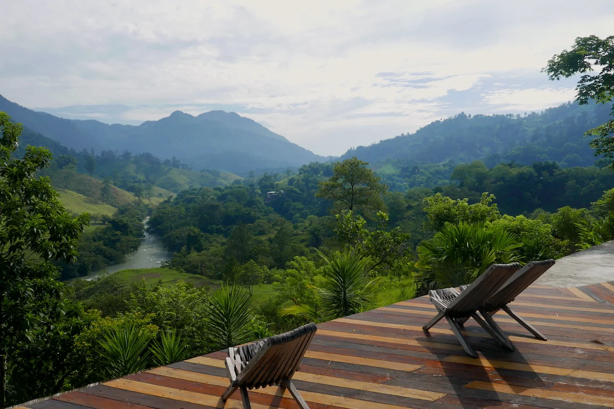
Even though getting everything sorted and actually getting up to Hacienda Esperanza (our accommodation) did feel like a great achievement already, that’s not why I want to meet you at a Finnish square.
It’s because talking to the park ranger revealed me to be the First Finnish Person to Come to El Cocuy National Park! And yes this moment deserves capital letters.

Imagine being the first somewhere. In the age of traveling being easier than ever and more and more countries becoming safe to explore it’s a wonder to realise there is a place no-one from your country has been yet.

Of course there’s the possibility that the park ranger was full of shit and says that to everyone that is not German, French or Dutch, and in reality I will soon find full coverage in one of the Finnish newspapers by other brave explorers.
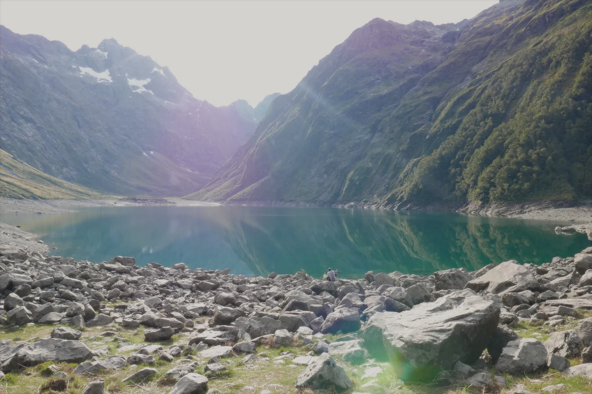
We did only one main hike because we weren’t sure about our ability to deal with the altitude and/or our general ability to hike at all. Long gone are the New Zealand hiking days and times of being in “glorious shape” as Richie would put it. As a warm-up on the day before we climbed up some fields, climbed & jumped over millions of fences, wire and electric, and (I) got (us) lost and did not find the lagoon we were looking for. But we had some great views so I’d call it a success.

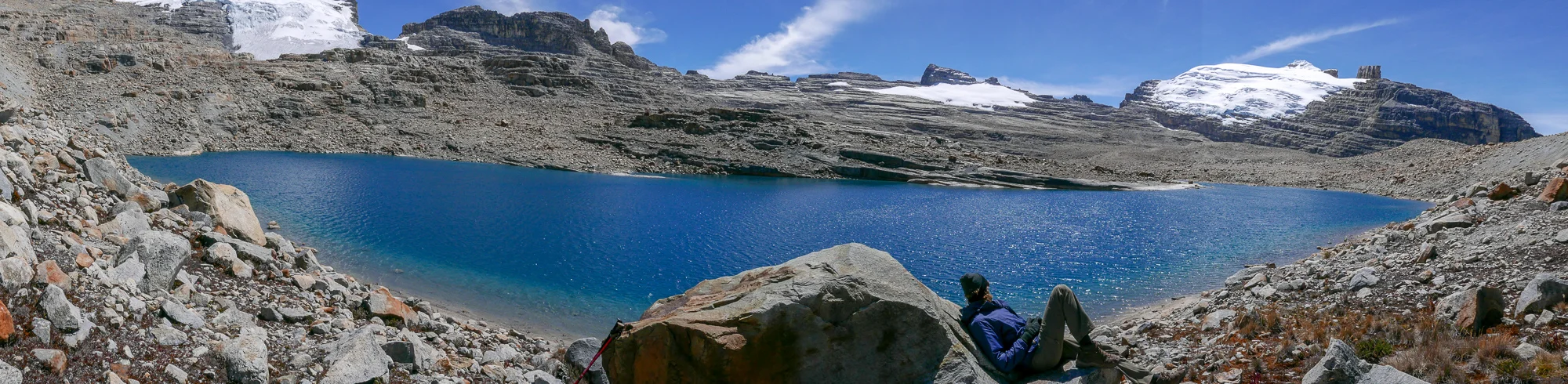


The park is beautiful, the people are friendly, the history is touching, the food is good and the company at the cabin was amazing.


And the plants are called Frailejones, cousins to the sunflowers we all know.
Maybe you will have a chance to become the second Finn here?
* Torilla tavataan!- saying is a common way to connect with fellow Finns when someone from Finland has done something great. Most famous example: Finland winning ice-hockey world championship. Then everyone met at the square, including yours truly.

Hiking essentials: Kindle and Valium
Hello, it’s us, the hiking couple again. Only that from know we should come up with new attributes to define us because we are done with hiking. For a while. Or at least hiking volcanoes. “Temples in Asia”- limit has been reached and we need to look for new ways to spend our days.
The laziness (or total lack of) planning our steps further than next day has led to some inefficiencies during our travels. Now this meant four nights in León. León is a nice enough place but after you have toured all the cathedrals, done tens of takes on the popular blogger-pose known as “look what I dropped” and ate all the bagels at El Desayunazo- restaurant there is not that much to do. In order to kill a Sunday we opted in getting a hungover from Saturday’s drinking and watched way too many Game of Thrones-episodes.


Most people come to León for the volcano boarding adrenaline experience. Our minds still thought also that we love hiking and thus we signed up for an overnight trek to El Hoyo, “The Hole” which included the volcano boarding, climbing up another volcano and camping there and swimming in a crater lake. Sounds like a piece of cake after all the kilometers and climbing we have done so far, let’s go!
Volcano boarding was something I almost did not want to do with my injured shoulder. I’d rather not roll down a rocky volcano slope with a dislocated shoulder, it’s just not something I would call fun. But after talking to a lot of people it became obvious that you can come down really, really, really slow. If you want to (and sometimes even if you didn’t).
And now I can say it’s not scary or dangerous at all! Unless you clock 70km/h. When you get to the bottom of the slope, you just want to go again, and faster.
When all the other groups headed back to León to start drinking, we picked up our backbags carrying 10 litres of water and food (which included a massive pumpkin, damn that thing must have weighed tons!) and set off for our second volcano climb. Hiking in Nicaragua is quite different to Guatemala in one aspect – heat. When it’s at least 30 degrees it’s not that fun to climb up carrying all your water for the next days. Luckily I was the one carrying Day 1 lunch so I got rid of couple of kilos right away!


Best part about this hike was our camping location. Beautiful area with beautiful views. If you don’t mind couple of horses and cows who might come in to your tent or even being trampled by cows (as had happened to one British teens group earlier) it’s a perfect setting.


Our spot for the night

Sunrise at the top

Company at the top
Since we are already somewhat experienced trekkers and have accumulated some equipment in terms of boots, pants and poles, it’s time to move on to some expert recommendations on what to bring with you on a hike. For us the first tips are a Kindle and Valium if your body does not think waking up at 6am and hiking all day is enough reasons to go to sleep. Not in every man’s backpack you say? Well, there’s a lot of free time during these hikes, especially if you are fast and reach the campsites early. Instead of being social and getting to know your fellow hikers, a Kindle will always offer something to do. And help you (me) to reach your reading goal for the year. And where wouldn’t you bring Valium really? Just joking, maybe.

Dinner preparations
The next day we woke up to some delighting sounds of nature – 18-year-old British girls screaming “wake up, wake up” at 4am – and watched the sunrise over the Lake Xolotlán.


Not bad
Descent and walk to the crater lake for a swim wasn’t as easy as I thought and running into the lake was a welcomed break after 3 sweaty hours in the jungle and sun.

On our way down, lake waiting for us

Finally here!
In summary, this was a nice hike but nothing I would call a “must-do” and hiking in the heat is just not something I like very much. We have packed our hiking gear to the bottom or our bags and doubt it’ll be taken out in a while. Time to do what I do best which is:
A) Reading at the beach
B) Reading in a hammock
C) Reading at the pool side
D) Checking our budget (we are under budget, yay!)

Hiking saga continues
The hikey people are back! We were almost lost roaming empty Western Australia beaches and flat-bottomed gorges where hiking boots, not to mention hiking pants, became obsolete and turned into space-wasting items I did not wish to carry anymore.
After a devastating realisation (panting during salsa classes) of how out of shape we truly were the hiking adventures started to scare me. What if climbing Acatenango is a repeat try from 8 years ago in Bali where we set out to climb Gunung Agung during the rainy season and I was not exactly fit for it after weeks of partying in Kuta? Me and my friends still refer to this adventure with disgust and resentment because after climbing three hours in pitch black dark, heavy rain, holding onto a torch while trying to climb vertical rocks we had to turn back. Because it was dangerous. Because “we don’t really recommend doing this during the rainy season” (after they took our money). Screw you Agung.
Luckily Acatenango could not have been more different. Good paths, sunny weather and professional hiking gear got us to the base camp in about 4 hours. Steep climb and definitely not an easy one, not sure if the Bali-me would have made it so effortlessly.


Approaching our base camp
The only thing left to do at the base camp is to look at the Volcano Fuego and take photos. Sometimes I wish I’d have more patience to figure things out well before I have an actual need for it and this time it was my precious camera. I sat on our hostel googling “how to take volcano photos” and a staff member was happy to show me couple of things. And only this way, 7 months after buying the camera, did I found out that my camera actually has shutter speeds up to 60 seconds (I thought 1 second was the longest..). Now I mourn for all the amazing starry sky photos I could have taken in Western Australia!


So, considering I just learned this and never actually experimented with longer exposure times I’d say couple of these volcano photos turned up quite nicely. Of course I missed at least five massive eruptions that would have made even greater photos but then again I heard some people going up there multiple times and before getting the money-shot. I don’t think I have the patience to become an actual photographer, too much waiting around with your thumb on the launcher. Although this part got much comfier when I discovered I can actually use my phone to take the pics remotely. No more sitting on the ground finger placed on the shutter! Downside was that campfire chats distracted me from the volcano and thus I missed many of the opportunities Fuego offered us that night.


The moneyshot!
Second part of the Acatenango-trip is to wake up around 3.30am to hike to the top (3,973 m) to watch the sunrise. Climbing volcanic sand should be familiar to us after Mt. Doom excursion but doing it in the dark without snow adds some excitement to it.

We were able to see Lake Atitlan from the top (for 2 seconds before the clouds rolled in)
When you finally make it to the top, you freeze your balls of. I brought all the warm clothes I have with me and got a proper jacket from the hostel and I was still struggling at the top. Wind makes -2 C feel like – 15 and taking photos is another type of challenge when you don’t want to take your gloves off. The views are definitely worth all of the suffering and I am just glad we got to see so much as some groups only see clouds or even worse, they get rained on for two full days in addition to not seeing anything..

Walking cinnamon bun at the top wearing everything she owns

"The tower sits in the front"
Do you remember the times when Facebook would ask you to write a "status update"? Yes, so do I. But my technologically challenged companion did not know what a status update is. And how difficult it actually was to try describe to someone that has not spend the last 10 years of their life on Facebook..
I feel like this blog is more fitting for our status update. Since food poisonings in Isla Holbox we have been up to a lot. But at the same time not much. Mainly chilling and documenting less of our lives.
- We traveled the rest of Mexico.
A whole week in Tulum, visiting cenotes, hitch hiking (OMG how could we do that in Mexico?!), a lot of rum and cokes at our hostel

Blurry Garden of Eden- cenote
Went to Chichen Itza, more about this can be found on the Ruins-post.
- We did a quick pit stop at Belize.
Quick because it's expensive. Shame since this really limits the places people see. Most of the backpacker folks we met stopped only at Caye Caulker and blasted through the rest of the country straight to Guatemala.
We did the (rainy) Caye Caulker for three nights. Liked it more than Isla Holbox, maybe due to absence of blood-thirsty mosquitoes but would not spend more time there. We opted out from the snorkelling tour everyone did, mainly because it was a lot of dollars but also because every tour operator feeds the sharks, the fish, the sting rays... The time of this type of interfering tourism should come to an end.

Sand of Caye Caulker
Other town worth mentioning is San Ignacio that's famous for all the cave action. Only I did not get any as the first day the ATM caves were closed due to rain (surprise, surprise!) and the second day I was suffering from food poisoning. Yes, again. Richie did the Crystal Cave-tour as ATM was still closed an apparently it was epic, awesome, amazing - use any word Americans would use to describe a regular day at work. Very challenging and adventurous so not sure how I would have endured there..
Keeping rain at Xunantunich ruins
Highlight of Belize was our hostel (D's) and specifically the owner in San Ignacio. The friendliest, most helpful guy we have met. Drove us to the ruins, helped us when we were down with the food poisoning, helped Richie get a refund from the tour operator who tried to shaft me, bought lots of beers for him and Richie while I was in bed with food poisoning, drove Richie around looking for food (which he got food poisoning from) and gave us a lift to the Guatemalan border the next day, while we had food poisoning. The hostel/guesthouse was awesome quality for money, never seen a bathroom like that in a hostel..
- Next up was Guatemala and as of today, 3th of November, we are still here.
Tiny town of Flores in the middle of a lake, Star Wars- ruins (officially known as Tikal), looong bus rides to and from Lanquín, a cave tour I was able to attend, the blue pools of Semuc Champey, the cold town of Antigua, tiny turtles and a resident mini-pig called Potato at El Paredon and finally studying Spanish and living with a local family here at Quetzalenango (Xela) for the past week.

Pools of Semuc Champey
Hostel views at Lanquin
My favourite phrase came to life at the beach destination El Paredon. After spending three days mainly laying at the pool/beach/bed and drinking beer it was time to go home in a small shuttle. Our fellow ride companions asked if the front seat was free and the driver answered "The tower sits in the front". I think all of you know who the aforementioned tower is..

All the turtles in El Paredon!

Sunrise at El Paredon

Quetzaltenango (Xela) views (and the tower)
What's next?
We have wrapped up our Spanish studies and instead of returning to the warmth of beach destinations, we chose to embark on a 7-day trip over the mountain ranges to a small town called Todos Santos to celebrate Día de Los Muertos. And four of the seven days we were hiking.
We haven't really hiked since New Zealand and we were out of breath after salsa classes. In other words I think we are in a shit shape.
But now the hike is over so we did make it! Photos and stories to follow once all the laundry is sorted, boots cleared from mud and once we've had couple of nights with more than 5 hours of sleep...

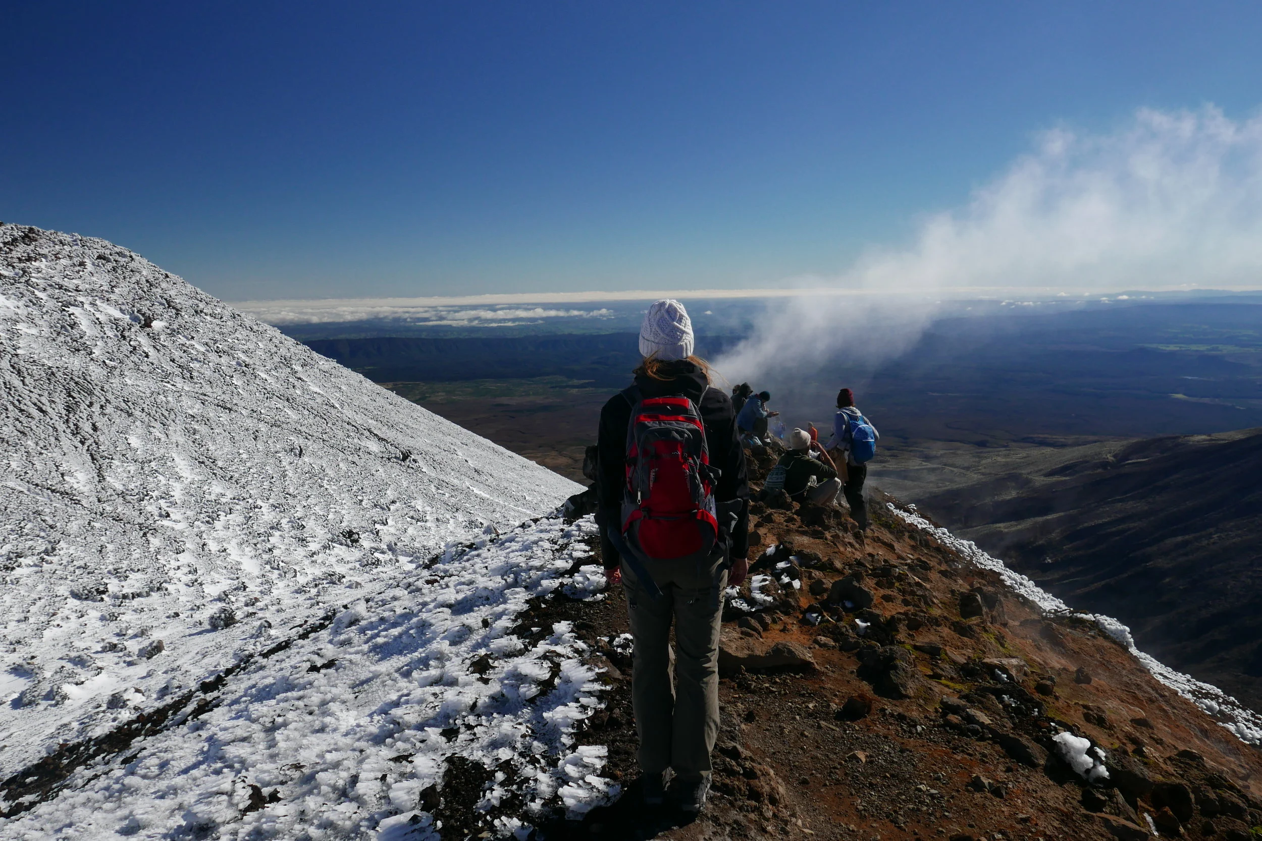
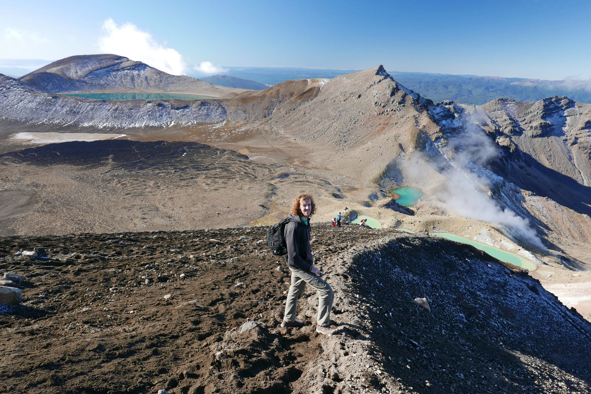
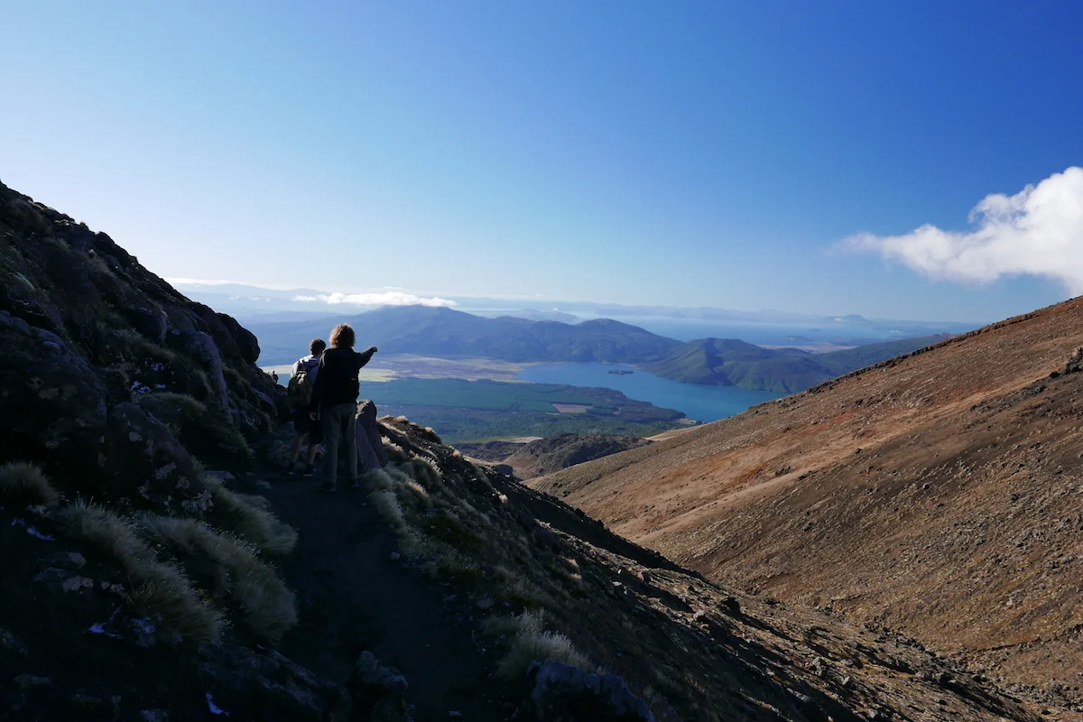
Tongariro Alpine Crossing
You know a hike should be good when it was changed to include ”Alpine” in it to make people realize how challenging it is. As New Zealand is such a popular travel and backpacker destination you have a lot of people trying to do some of the great hikes wearing jean shorts and ballerina shoes.
But not us, we were prepared with our hiking boots and hiking pants! Ready to judge those Sunday walkers who thought this was an easy stroll, look at their inadequate gear and laugh condescendingly.
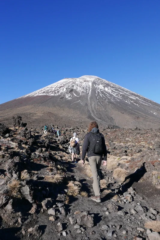
The crossing is 19,4km long including a lot of climbing and a bit more if you decide to climb Mt. Ngarurahoe (also known as Mt. Doom).
This 19,4km would be much more challenging than our 20km leisurely stroll in Abel Tasman. Of course we thought the time estimates exaggerate by hours and though that by starting at 8am we’d be finished around 2-3pm, including the climb to Mt. Doom.
Prior to the Sunday we spent a very cold another thing to look out for – Saturday saw 75km/h winds when 50km/h is the max the recommendations say you can do the hike in. We got very lucky with the weather and Sunday was meant to be perfect.
As the crossing is not a loop or a return track you need to either have a shuttle to bring you from car park to another or arrange a group with two cars. Luckily we had two cars as Richie’s friend from Brisbane, Josh, who night in a close-by free camping spot full of other travelers aiming to do the crossing. One needs to check the weather reports very closely as not only clouds ruin the views, it might be dangerous not to be able to spot the route markers in some of the steep climbs. Winds are now lives in NZ was joining us for the hike and so we avoided paying the $30pp shuttle fee. The car parks fill up really quickly – we left one car at the end at 6.30am and we’re at the start at 7am and got some of the last close spots in the small parking area.

This was definitely the busiest of the walks we have done in NZ, groups of people starting in regular intervals. As we are hikey-people now, fast and confident with our gear, we flew by other people!

Start of the walk, Mt. Doom looming upon us
It took about an hour to reach the point where one has to make the crucial decision: To climb Mt. Doom or not? Sign says 3hrs return and that’s quite a bit to add to an already 6-8hrs long walk. We could already see a lot of people scrambling up and decided to do it.
I thought Cradle Mountain Summit- climb was challenging but at least there you were walking/crawling on solid rock boulders the whole way. Wherever you reached for a grip you knew you could trust. At Mt. Ngarurahoe the ground is deceiving in every step. It’s mainly loose volcanic rock, which can be very sharp and breaks easily, and often means one step forward is two sliding steps down. Since winter is approaching there was already a bit of snow on the way which actually made the climb easier. You could make proper steps and hope the snow doesn’t give in under you weight.
Another thrilling feature of the climb were “Rock!”- yells from other fellow climbers now and then. None of the falling rocks were big but it is steep enough that they don’t really stop before the bottom and at full speed those could have very bad consequences and some people have had to be rescued from this exact mountain after being hit by a falling rock. We heard a story about a guy who dropped his bag on the mountain and it rolled most of the way down with the volcanic rocks tearing it to shreds on the way!

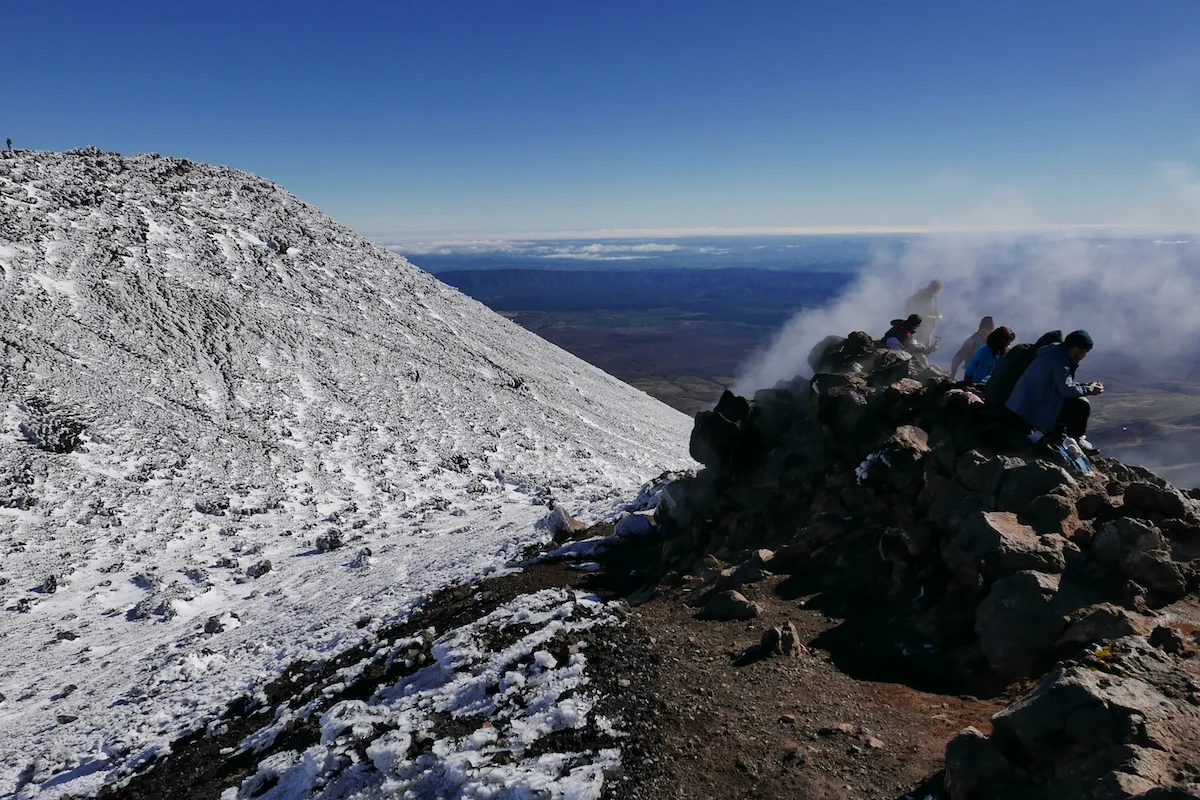
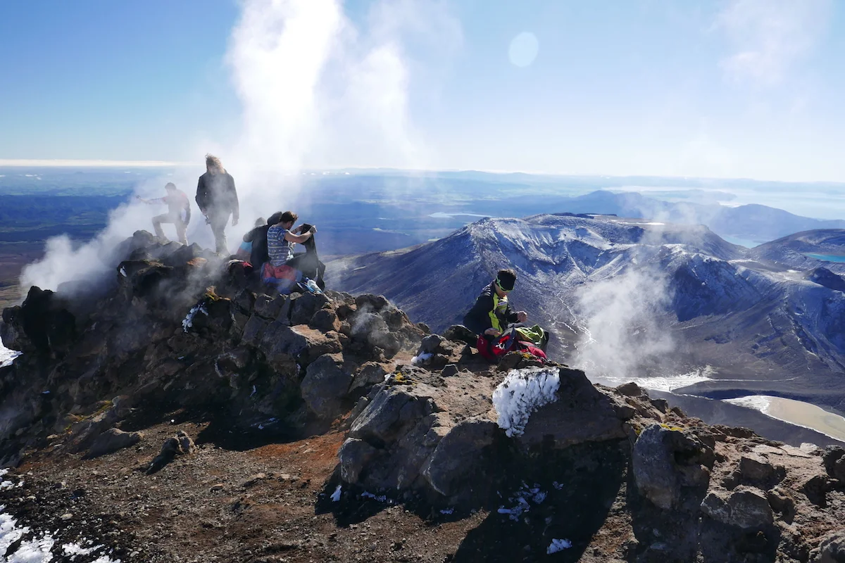
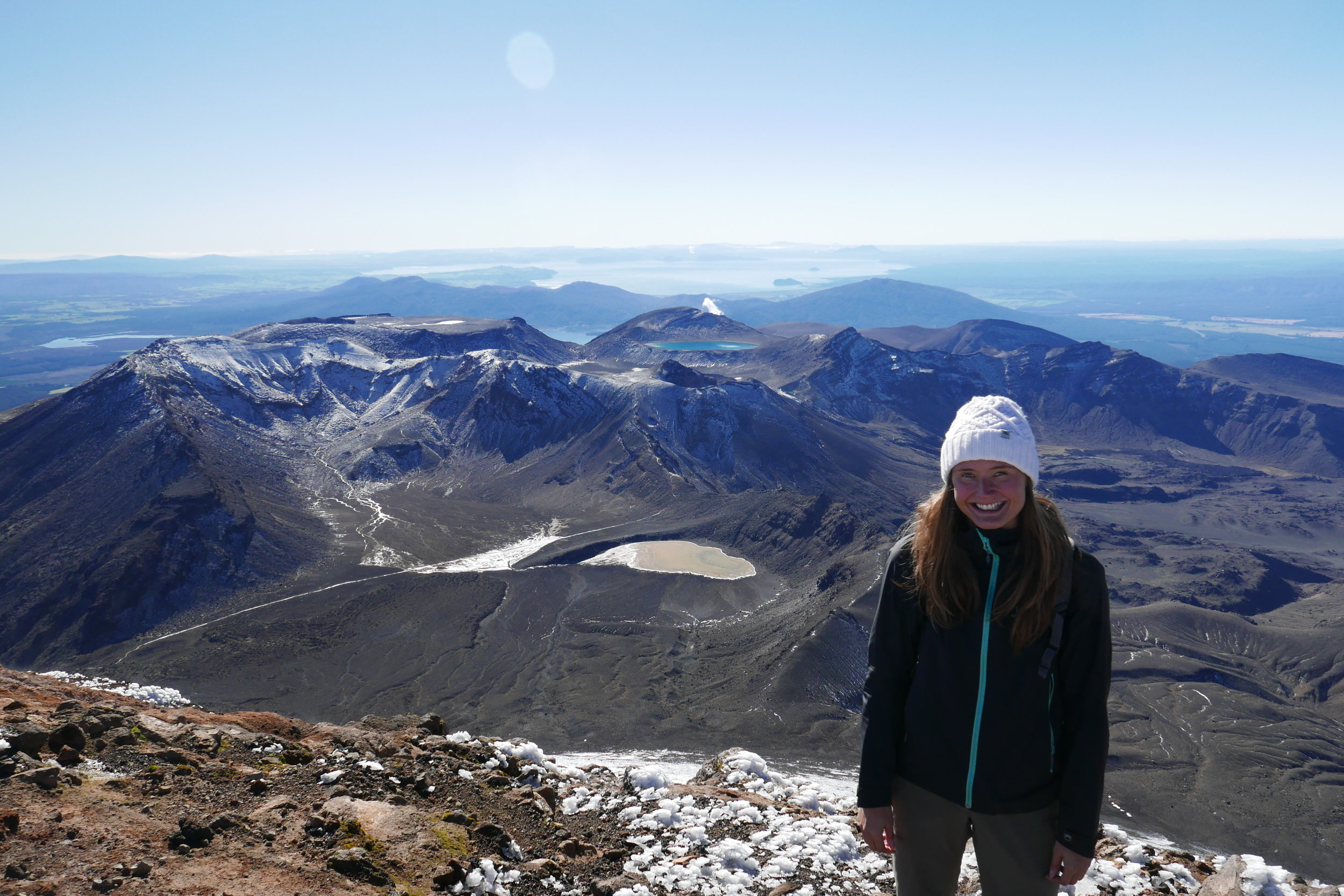
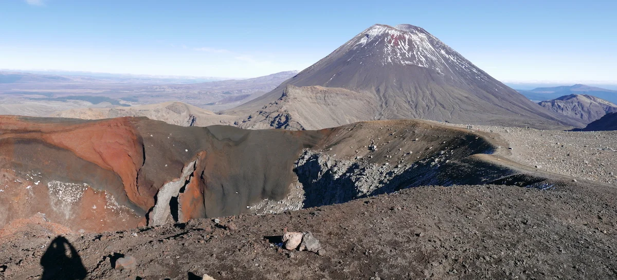
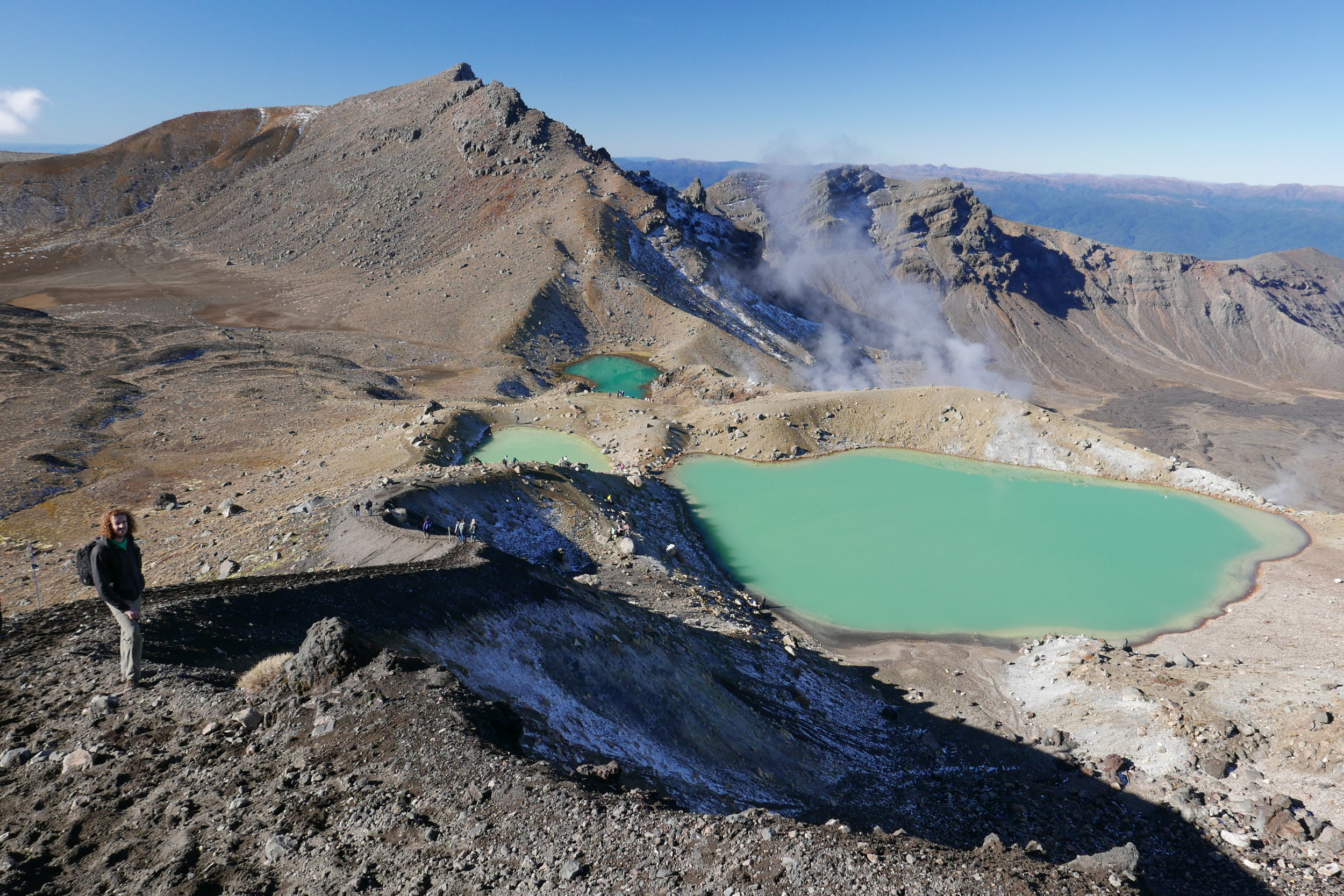
After closer to 2 hours of climbing we finally reached the top. You can either choose to go to the “Frodo ring”-side or the actual highest point – or do both if you have the time and energy. We sat on the warm rocks, surrounded by the steam from the volcano now and then, enjoying our lunch.
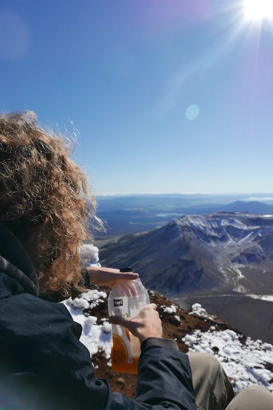
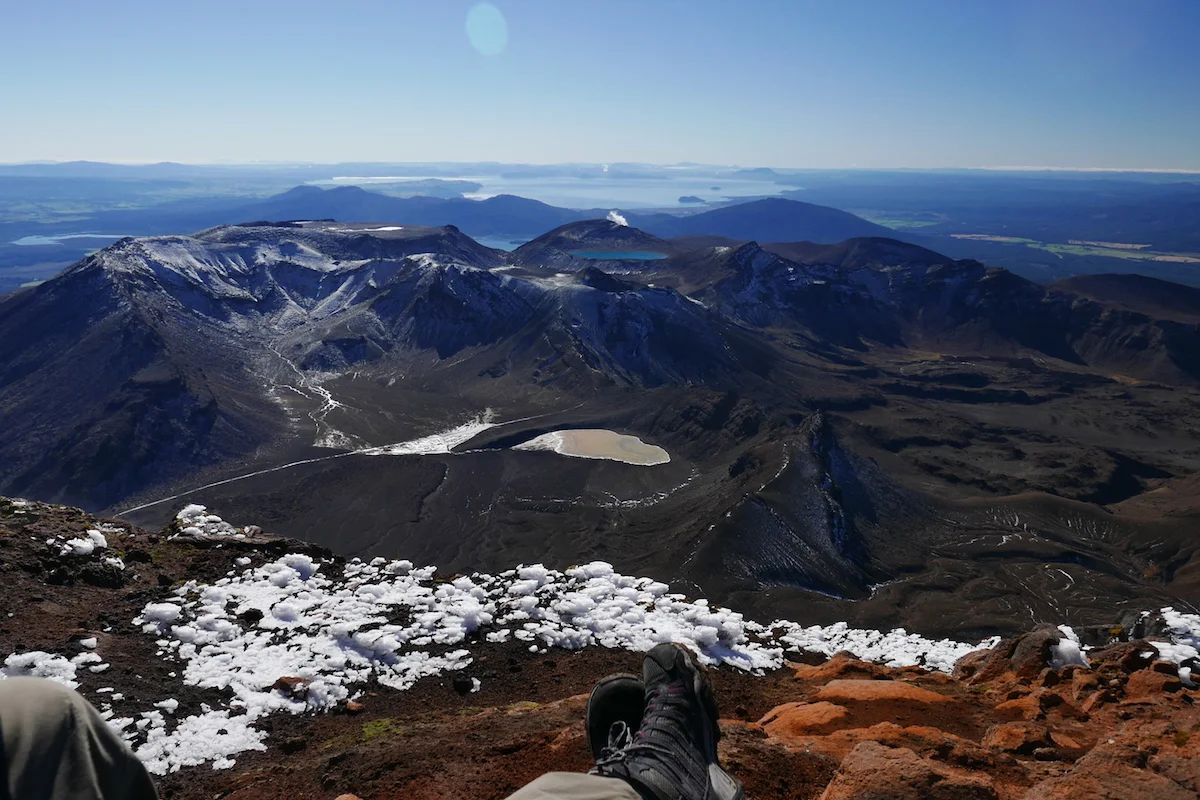
I only found out later (should have read all the Wikipedia info before doing the crossing) that nothing was actually filmed at the top of Mt. Ngarurahoe as it’s a sacred Maori place. This mountain was used as a place-holder and the close-up scenes we’re filmed at Mt Ruapehu so any of the ring photos people took are technically at the wrong mountain!
Coming down was a lot quicker. I started out slow and carefully backtracking my steps but the guys were already half-way down sliding on the snow and gravel on their assess and running along with the sliding gravel. Sliding down was actually a lot of fun – except I worried of my pants tearing open at any point – but you really needed to focus on not going too fast or twisting your ankles. Coming down I dreamed about fresh snow and snowboarding it because people do ski these walls down during winter.
You know the feeling that you’ve accomplished a lot and you think the majority of the walk and work is behind you? Well that’s how we felt after being on the road for 4 hours until we saw the main walk signs saying we still have majority of the actual walk left – 13,4km to be exact. I also had promised to the guys that “yeah I think majority of the climbing is behind is” and I was quite wrong on saying that because the main climb of the crossing was ahead of us.
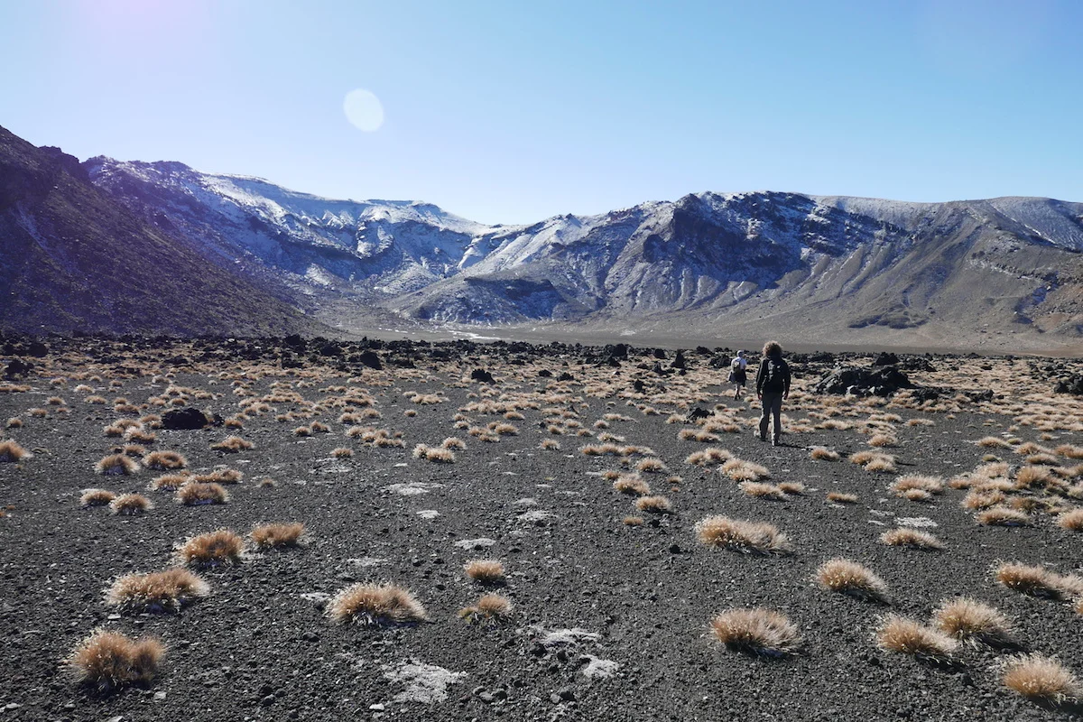
After the climb you get to the most-photographed point of the Tongariro Crossing – Blue pools. A lot of people walk here and then turn back and later I learned why. The crowds were definitely thinning the further we walked, at the Emerald Lake we barely saw anyone and after that the paths were clear for a long way.
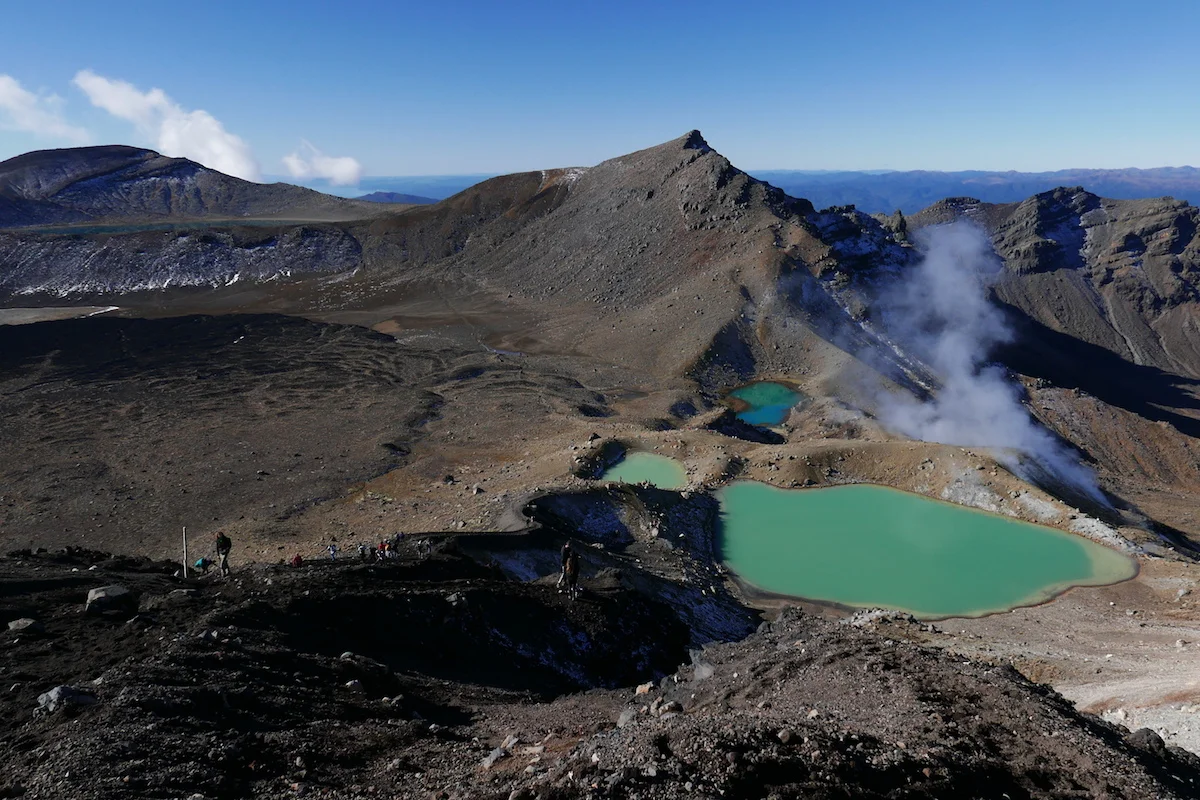
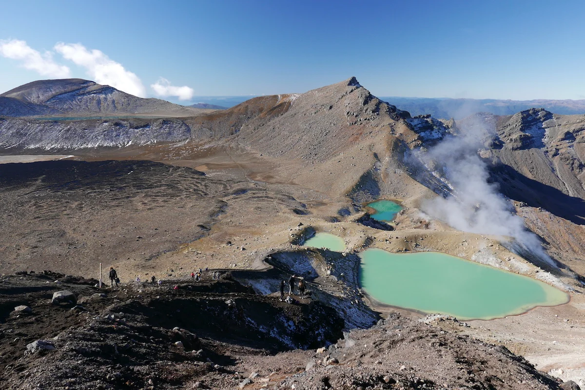
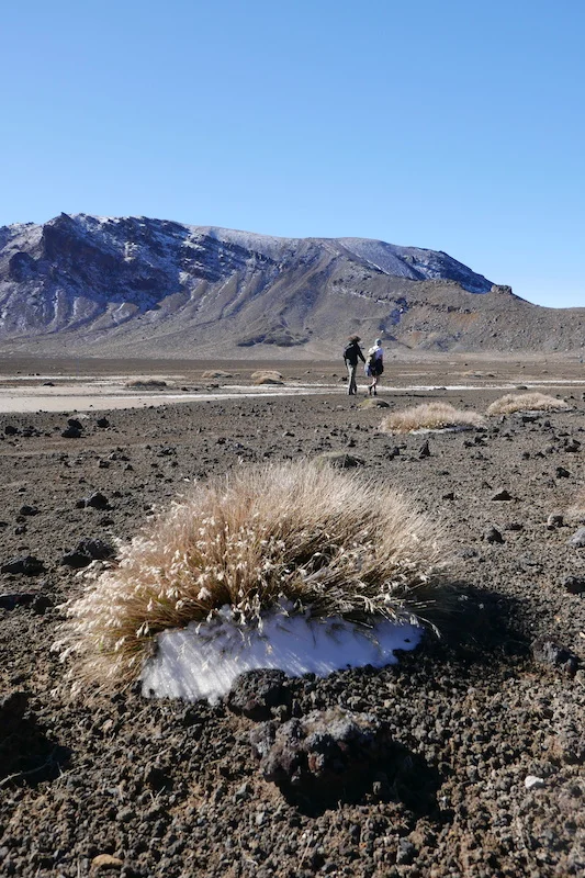
It turns out that all the kilometers after Emerald Lake is very, very boring. And there was still almost seven of those kilometers left. And the worst part is that you can see the pathway going down the hills, you can see it far away in the horizon so it doesn’t stop mocking you and your tired pace at any point. You feel like it won’t end, ever. You calculate in your head that “surely we’ve come 6km now, there should only be 1km left” and then you see a sign telling you “3km to go!”. %!€%#!”!!€
Still 7km to go..
We did made it in the end, the time was 5pm so we weren’t nearly as fast as we thought we would be but at least we got out before dark. Only the painful drive to pick-up the other car from the start through one of the worst gravel roads I’ve seen – in the morning already three cars had punctured tyres.
Instead of spending another extremely cold night in the car without a shower I used my “I am an adult with some money and I refuse to live like this”- card and got us a room in a hostel/motel. Best decision ever.
Definitely the most challenging walk and of the best ones in terms of scenery we’ve done and I would recommend it with Mt. Ngarurahoe climb – I bet without it this wouldn’t feel as rewarding ;). I might consider walking it the other direction because then you have cleared the most boring part first and after the mountain climb you have only 6.6km to go instead of 13.4.

North of South
After three weeks we’ve dutifully ticked a lot of the New Zealand bucket list boxes. After a while you get tired of ticking those boxes. Another waterfall, another rock formation, another hike. At this point we started to relax a bit and just drive without thinking a set agenda too much.
On our way to the Northern point of South Island there was only one “must see” – a rock formation! I took way too many photos of rocks and as you can imagine, none of those came out showing exactly what our eyes saw. I think I need a little bit more practice on this photography thing..


The major destination for any New Zealand goer is Abel Tasman National Park with its sandy beaches and turquoise waters. After the snowy mountains and glaciers I can understand how this place attracts visitors as it is a beachy heaven you yearn after a long a cold winter.
In Abel Tasman you could walk the whole 60km long track in a couple of days but as we had been sick we chose a “light” 20km walk from Torrent Bay back to Marahau. You have to get a water taxi to drop you off and then you make your way back. During the taxi ride we got to see sea lion pups which was another animal highlight for Richie!

Dog puppies of the ocean
The walk itself is very easy, a wide beaten track and I can just imagine how busy it must be during the high season. Majority of the walk goes in the forest and you’d need to go down to the beaches along the way. We were in a real anti-hike mood and as you can’t dip in for a swim we didn’t see the point of adding extra hours to our walk and just kept going. Pretty boring walk this way I must say.
(click the arrows to browse all Abel Tasman photos)


In the end we’ve had enough of walking in the forest and chose a “short-cut” through the low-tide exposed sand. Hiking shoes held the water up until a point and then we had to go barefoot. Not sure if it was a short-cut at all but at least we got to see something other than trees.

Short cut to Marahau
Another way to experience Abel Tasman would be a kayak-tour and I think I'd rather opt into this one than walking as you get to see more views and park at whichever beach you want to!
Since we were quite ahead of our schedule the next day we decided to pay a visit to Golden Bay after all. And glad we did! The drive through the mountains is rewarding on its own and we were lucky enough to have amazing clear skies and you could see the whole bay itself.

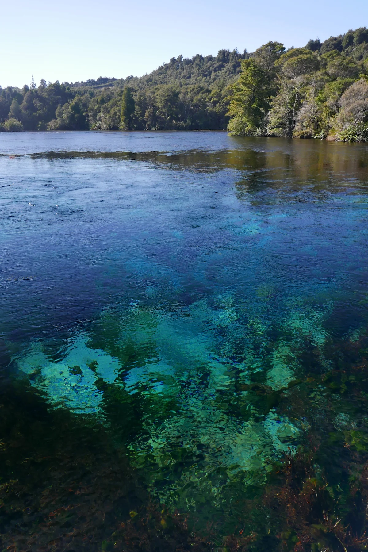
First stop was Te Waikoropupū Springs - fresh water springs which were almost empty of other visitors and one of the most peaceful & tranquil places we’ve seen. One could have just sat there all day staring at the water.
(click the arrows to browse all The Waikoropupu Springs photos)


Next up (in the hope of more sea lions) was Farewell Spit but the weather turned very grey and we did only a short walk along the beach line.
I also spotted (excitedly) a “special” lamb that was walking on its knees while everyone else around it was acting as normal sheep do. Unfortunately my vet-student sister educated me that most likely anytime you see a “special” animal, there’s something medically wrong with it. In the case of this lamb, its joints must be hurting and it is easing the pain by relying on its knees :(
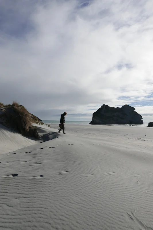
We had one more stop left in the Golden Bay list, Wharariki beach. I didn’t expect much, just a quick short walk to the beach and back but how wrong was I! And stupid as I didn’t bother to carry a spare battery for my camera..
The walk to the beach went through the most green hills I’ve seen in New Zealand so far. This photo did not need any editing, these were the real colors.

The beach itself invities you to have a looooong relaxed walk. These we’re the only photos we were able to take before the battery died.
(click the arrows to browse all Wharariki beach photos)


And right after this we ran into the cutest thing ever – sea lion pups playing in the shallow pools. There were so many and they weren’t shy at all! Of course some of the people hadn’t bothered to read any of the warning signs that told to leave them alone and keep your distance and were actually in the pools with them…
This side of the beach was just the beginning and we walked all the way to the other end. This allows to see the famous rock formations from different angles and take all the amazing photos you want to. Now we had to just enjoy the views with our eyes.
Wharariki beach is easily both of our favourite place in New Zealand. Would not have expected that!
Now the only thing left to do in South Island was to escape cold and catch a late ferry from Picton to Wellington.

Queenstown time!
This would be our holiday from holiday. A couple of nights in a proper bed in a hostel with shower and Wi-fi included was a welcomed break from sleeping in the car, trying to find a place to do our dishes. It was also our chance to socialise if we’d still know how. About 4 weeks 24/7 together without other human contact than a random Pak’n’Save cashier can make you feel a bit alienated from the social circles.
The arrival day was a sunny one and we spent some of it just sitting on the beach, watching a group have a swim (clearly a dare as the water is well below 10 degrees) and I drank coffee from Starbucks, my first $4,50 coffee since I quit working. Can’t afford that luxury anymore..

Queenstown had a familiar ski-village vibe and I could have stayed there for the winter season, just snowboard and do nothing else for 4 months.. Facebook's 'On This Day...' reminded me that it’s 9 years since my winter in the French Alps and that’s way too long ago. I started secretly planning to make Richie a snowboarder so that we could move to the Alps for one winter but not sure when we’ll have time for that.
Since the winter has not arrived yet, we had to find something else to do than snow-related activities. Only thing is that all these adrenaline-escapes Queenstown is so known for are very, very expensive. How about $200 for a swing that lasts a couple of minutes? Same for a bungee jump? After going through a thorough cost-benefit analysis we chose rafting and a skydive for me since I’ve never experienced the joys of a 45sec freefall.
We rafted the same river that was used for the scene where Arwen rescues Frodo. Didn’t see any water horses as the water levels are lower in autumn but we got some exciting rapid descents and a lot of relaxed paddling during the 2,5 hours we spent in the river.
On the road to Paradise
Since we had the leisurely luxury of just winging it on some days, we took our car for a day-trip to Glenorchy, Paradise and even further. I had some hazy directions of a place where Gandalf rode to Isengard and despite not being the most obsessed LOTR-fans we decided to follow the narrowing roads there.


Once we had spent way too much on activities it was time for the other type of financial extortion Queenstown is known for – nightlife. Only to find out we can’t really do nightlife and alcohol anymore.. Went to bed at 12.30am, mostly because (this is what we tell ourselves) the next day was our only chance to do the full-day Ben Lomond Summit hike and we didn’t want it to be more of a suffering than it already would be.
Ben Lomond Summit is a 6-7 hours return trip that climbs over 1,100m from Queenstown to the Summit. To this date, the most vertical climb we had done was Cradle Mountain Summit which was apprx. 600m so it was interesting to see how this turned out.


It was a long walk but worth it! Especially when couple of those birds from my nightmares showed up and were every bit as cheeky as the stories tell. One of my favorite moments was three of them surrounding Richie slowly, leaving him with a deathly 20m rocky fall as the only escape route. Clever Keas!


The walk back was very painful, we must’ve caused some weird looks and laughs as the last 2km was walked partly backwards to give our toes some rest.
Only thing left to do in Queenstown was to go purchase the next hiking item – hiking trousers! We had done careful comparison over the four days and believe or not – Richie spent over 100 dollars on pants. Unfortunately, both of us liked the exact same brand and model so I said I would get the beige ones and Richie green to avoid the “matching trackies”-phase of our relationship. Only to find out well out of Queenstown that I bought the green ones as well so I guess we are at the matching phase now!
Lastly – don’t know how I left this last – Fergburger is as good as they say. Ate there twice. Best burger place I have ever been to.

Night terrors at Fjordland
They say New Zealand has it all. And now I have started to understand this statement a little better. So far, we have seen mountain scenery you could experience in the European Alps, walked on empty beaches with waves ready to be surfed and driven through thick forests and Windows XP-green hills.
What else could this country have, isn’t this already enough for 4,7 million people?
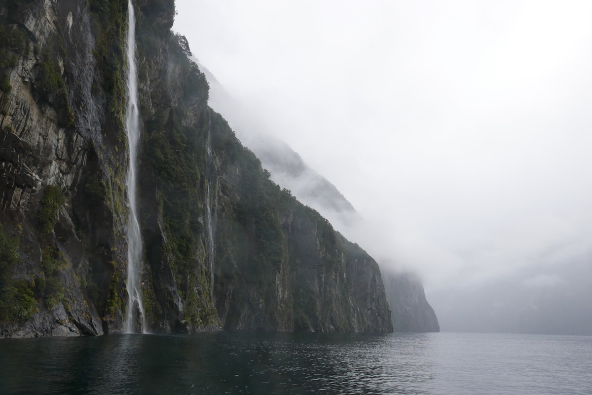
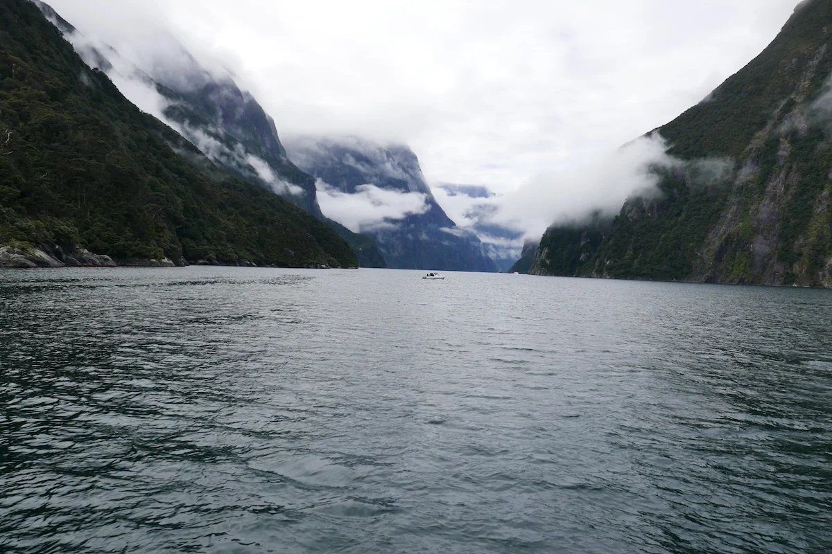
Fjords. You know, those things that Norway is really proud of. Only to find out that someone is better at branding than them and calls their fjord “the Eight Wonder of the World”. Milford Sound is maybe the most famous fjord in the world so Norway you’d need to step up your game a bit. Or stop being so expensive, either would work.
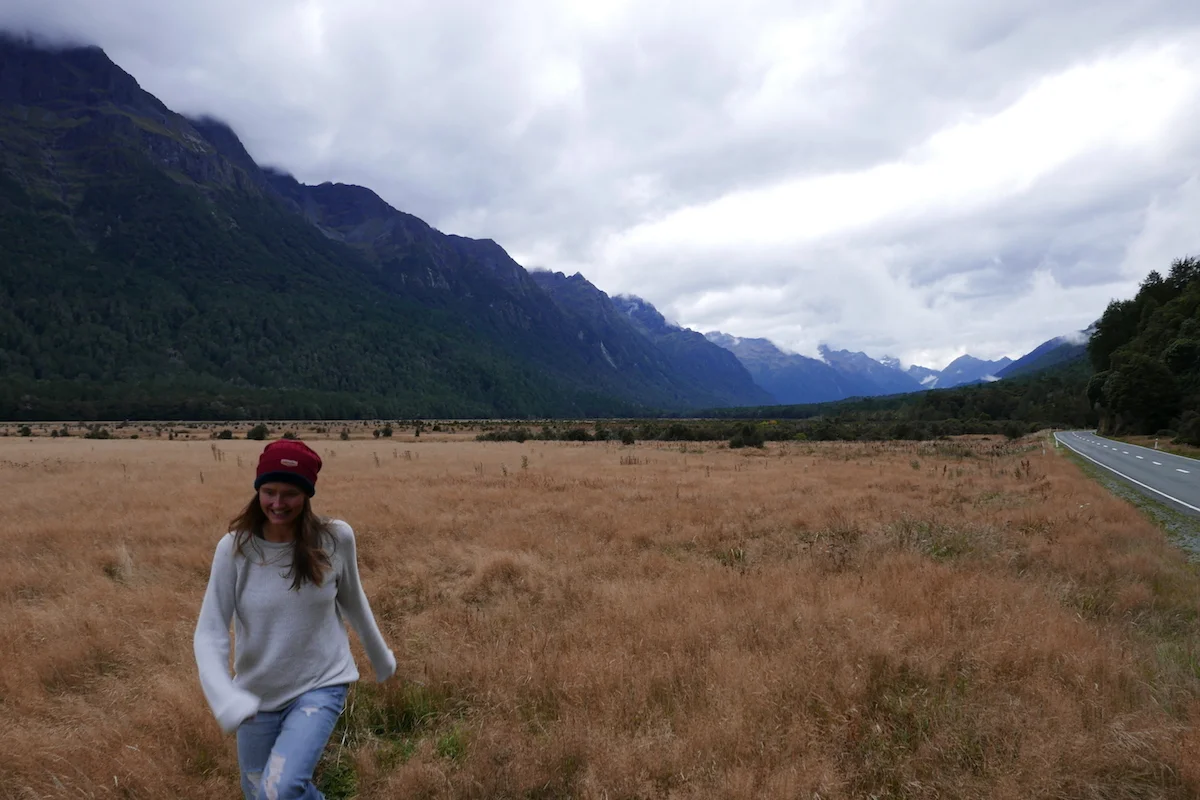
The drive to Milford sound is beautiful and has those famous wheat-colored fields that make such a good “hey look at me walking casually in the middle of tickling crops while stepping into mud and god knows what”- Instagram moments. I had just tried to describe to Insta-clueless Richie the perfect field-photo he would need to take when we spotted the perfect field – with about 20 others trying to take that same photo.
Knee-high at its best...
The crops weren’t that high though – or I am just taller than an average travel blogger/Instagrammer? – so my photos don’t really convey the vision we had. Richie the Art Director told me to gallop, run and jump graciously and I tried with not-so-photogenic results. I guess you need to take 100 photos to get one good shot, right?


After the mandatory photo session, we found our camping spot and did a weekly cleaning. I say weekly but up until now that is the only time we have done it. While all the doors were open, a little friend flew in. I remembered the Kea warnings and was sure it was going to steal everything it possibly could and tried to make loud noises and gestures (that’s also how I speak sometimes) and a tiny black bird came out. It wasn’t afraid of us at all, hid under the car and tried to go back in at every opportunity it got. As it wasn’t the evil Kea, I didn’t care that much and we finished cleaning.
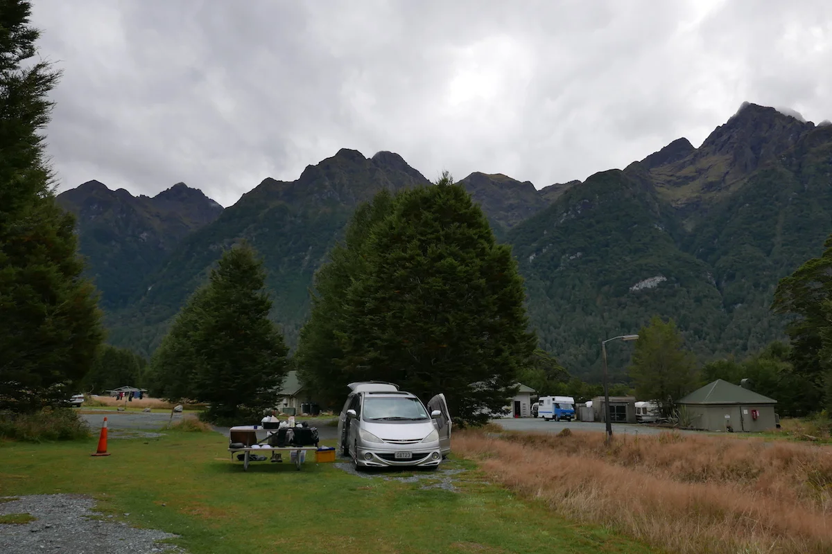
And the night came….
Camping spots are usually pitch-black dark unless you are in a holiday park. Here we were also the furthest away from any buildings or other cars.
We were watching our daily dose of Modern Family when I heard a weird sound. Like someone really small trying to knock on our car. Possibly nothing, continued watching the show. Until we heard that and weird digging-through-our-car noise. I was starting to freak out, sure of that the evil Keas had come and they had a master plan to destroy us.
Richie went for a look outside, didn’t see a thing nor any marks on the car.
But the noise continued, only stopped when we knocked the trunk door back. This went on until it was time to sleep and I opted for ear plugs since ignorance is bliss. I woke up couple of times during the night time hearing the same noises so this wasn’t the most relaxed night.
Surprisingly the next morning there were no signs of our night guests. No marks in the car, nothing. Explanation came when the friendly ranger told that the robins (the tiny friend who tried to sneak into our car) like to eat the insects off the car. What a relief!

Foggy morning drive to Milford Sound
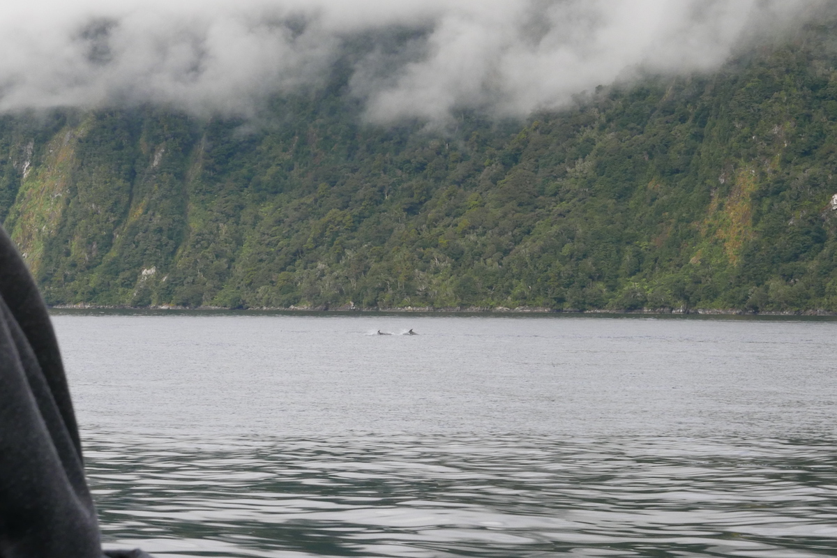
Now that the night terror mystery was solved we could head off to our Milford Sound cruise in peace. The prices for the cruises are usually $80+ but thanks to bookme-site we got ours $40 each. Waterfalls, fog, more waterfalls and then to Richie’s great joy, closer look at sea lions! And after that, playful dolphins. Take that Norway, I bet you don’t have fjord dolphins?!
(By the way, the popular Live-stream of a Finnish freshwater seal, saimaannorppa, is coming back this May. Tune in here https://wwf.fi/en/norppalive/. In previous years we have watched a seal mostly sleep and turn, named it Pullervo ("tubby" could be the closest translation) and saw it finding a partner. People had their second screen at work tuned into Norppa-Live all day.)


As the weather wasn’t the best we skipped a longer Gertrude Saddle walk and chose Lake Marian track instead. 1,5 hours climbing in a muddy path in the forest and at the end you are rewarded with a beautiful mountain lake. This put our hiking shoes to a true test and we survived all the mud! Lululemon active wear pants didn’t though and this was the moment we started to plan the next item in our path-to-become-hikers- purchase list.

From all the places we’ve seen in NZ so far I’d spend more time in Milford Sound and spend that time on multi-day hikes such as the Milford, Routeburn or Kepler track. Too bad you need to book these super-popular routes well in advance, the booking opens now for next summer..
But also, seeing all this makes you also appreciate what is close to home. Lapland and Northern Norway was the destination for our childhood trips and only know you come to realize how beautiful and unique those places are. Norway the Eight Wonder, Milford Sound the 9th ;)

Heini's hiking adventures: Cradle Mountain
Hiking the Cradle Mountain Summit in Tasmania
When I started planning our journey across Australia, New Zealand and South America, it became clear that one activity would top all others in every destination: Peaceful strolling in beautiful scenery, admiring the views and stopping to have lunch at picturesque lookout spots.
Or: Climb vertically over boulders for 1,5 hours after you have already made your way up 2 hours from the starting point thinking it'll be an easy and nice day and surely we will do the track much quicker than the estimated 7-8 hours. Time for tea stops, photo stops and another tea stop.
Latter describes our first bigger hike, Cradle Mountain Summit Walk.
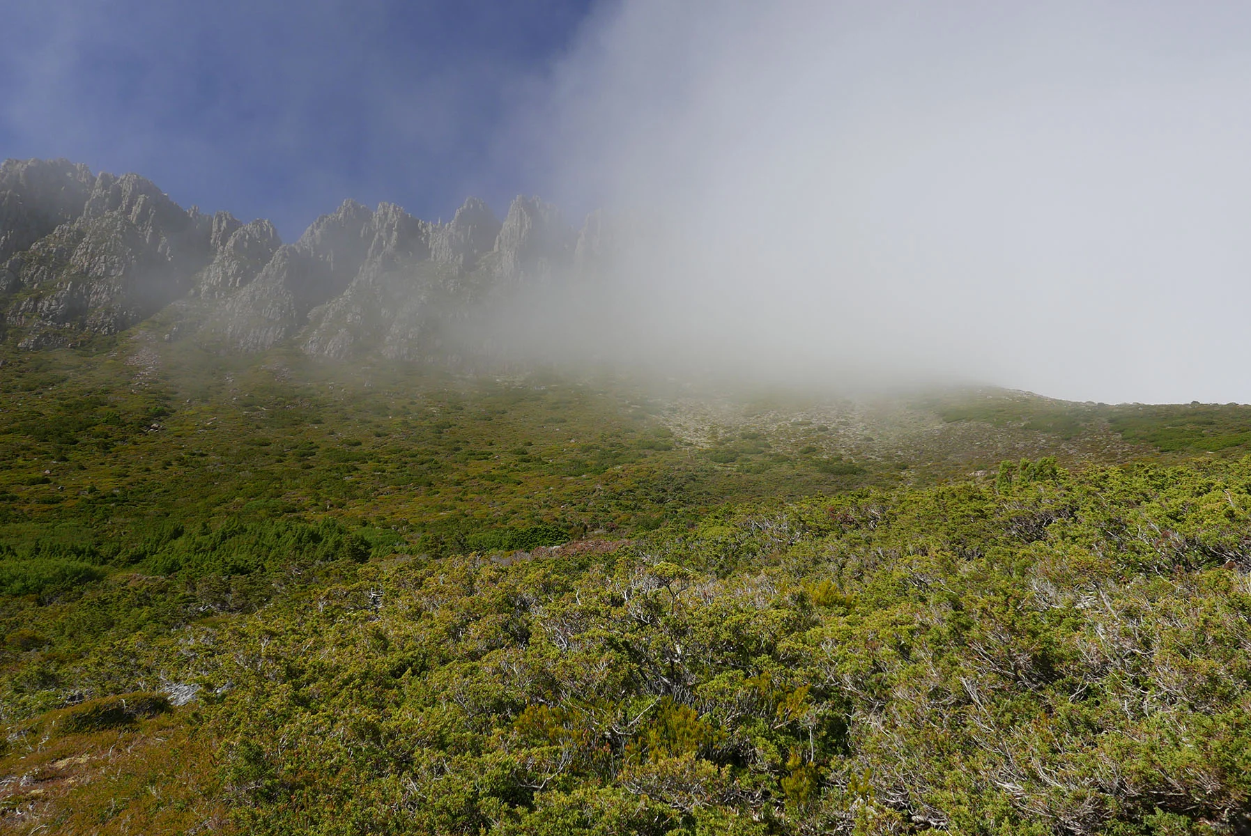
Cradle Mountain National Park is home to many iconic walks and scenery that felt really familiar but only after we started the walk I realised why. I was in Lapland again! We didn't have time (or the gear) for the legendary walks such as the Overland Track so we opted in to the longest one you could do in a day, conquering the summit.
Original plan was to do this on Friday but rain and thunder forced us to take shelter in close by Gowrie Park (real bed, shower, kitchen!) for two nights waiting for better weather. I wouldn't want to be scrambling to the top over the rocks in pouring rain.
Alarm went off 5am on Monday morning and after hefty breakfast we set off to the route. Sunshine all day but with strong winds - it was cold but we were used to that already..
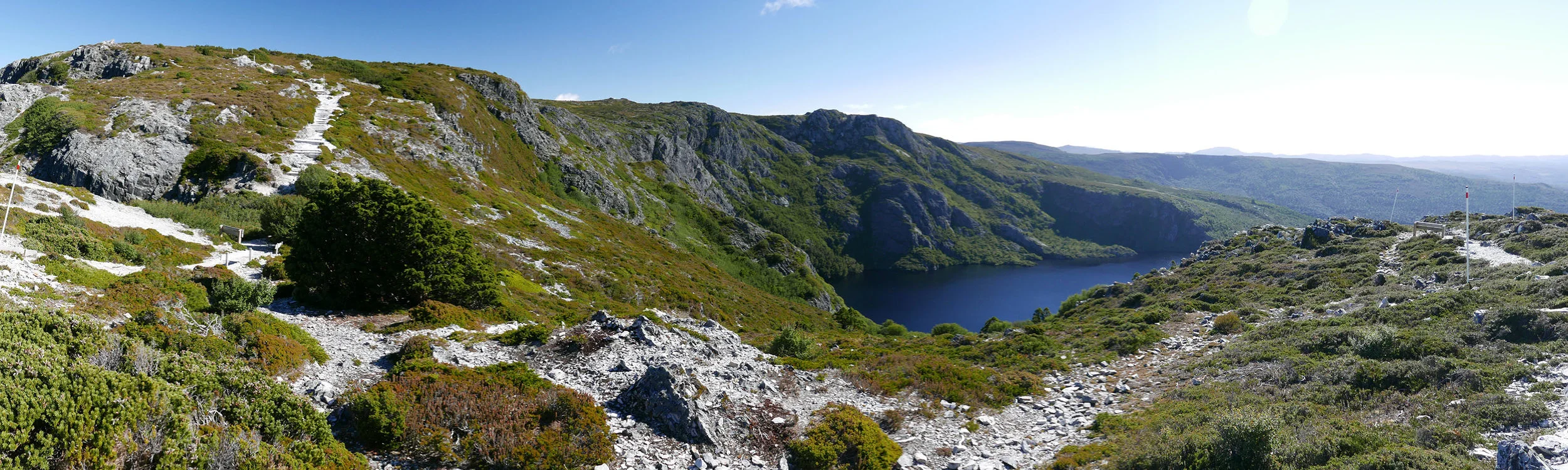
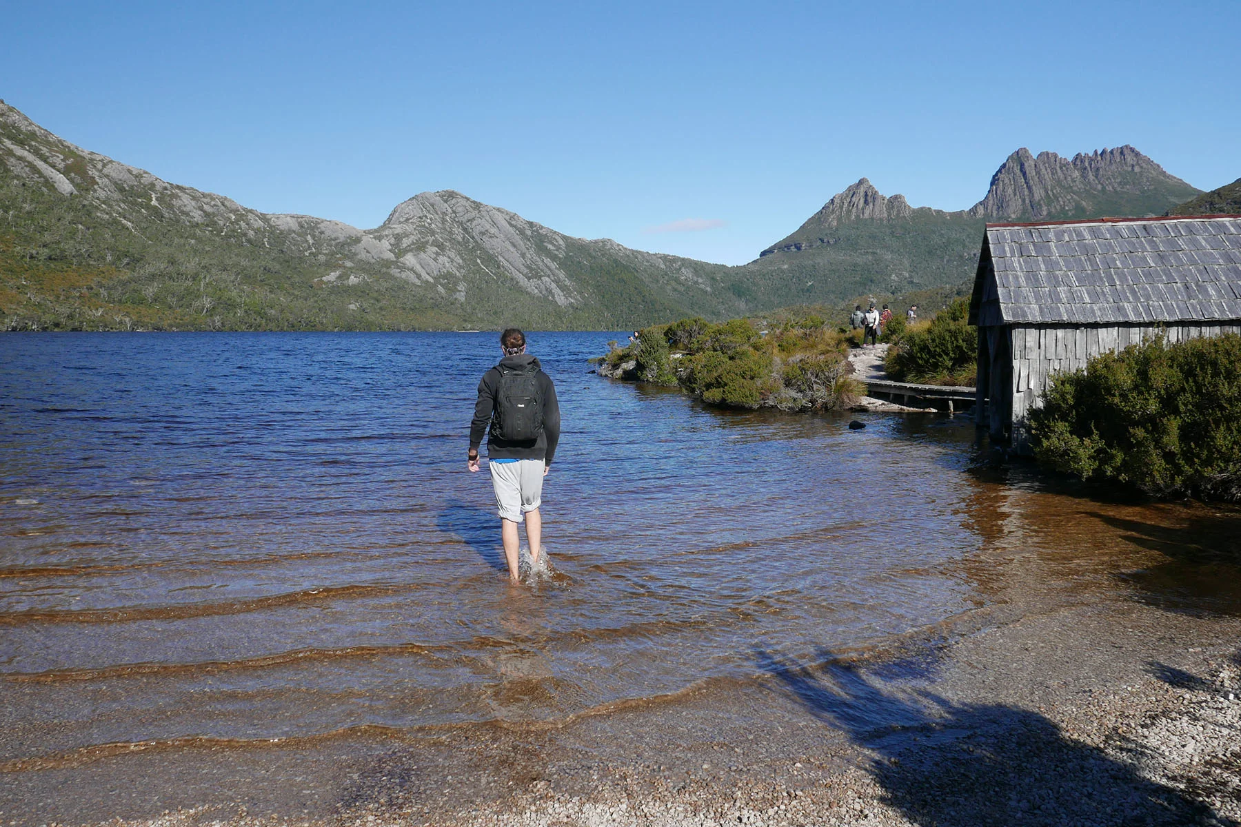
The Summit walk starts at the same location many of the shorter and easier walks are located as well. You can choose one of the three possible routes to get to the Summit part, we chose Dove Lake. We got to enjoy the first leg of the journey with almost no other people around and the views were stunning.
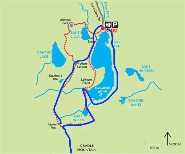
Our route in blue, link to original photo.
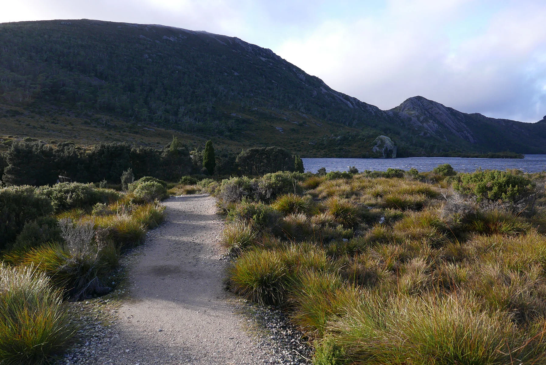

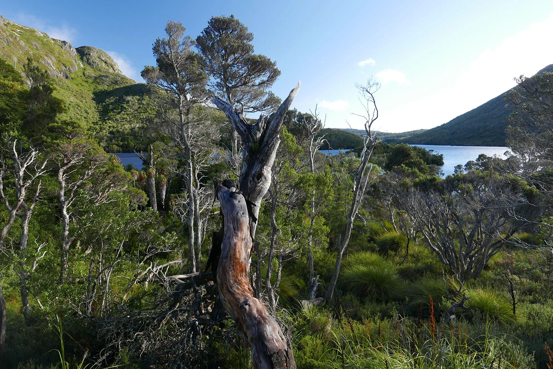
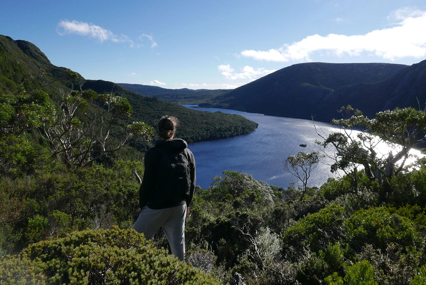
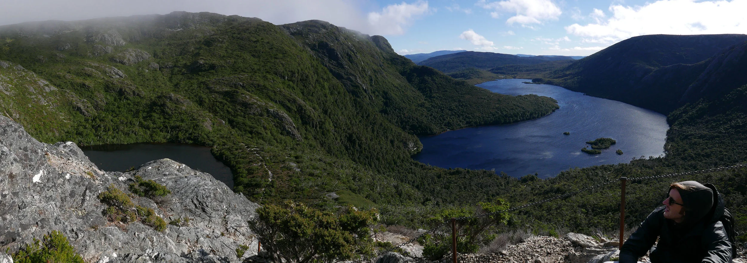
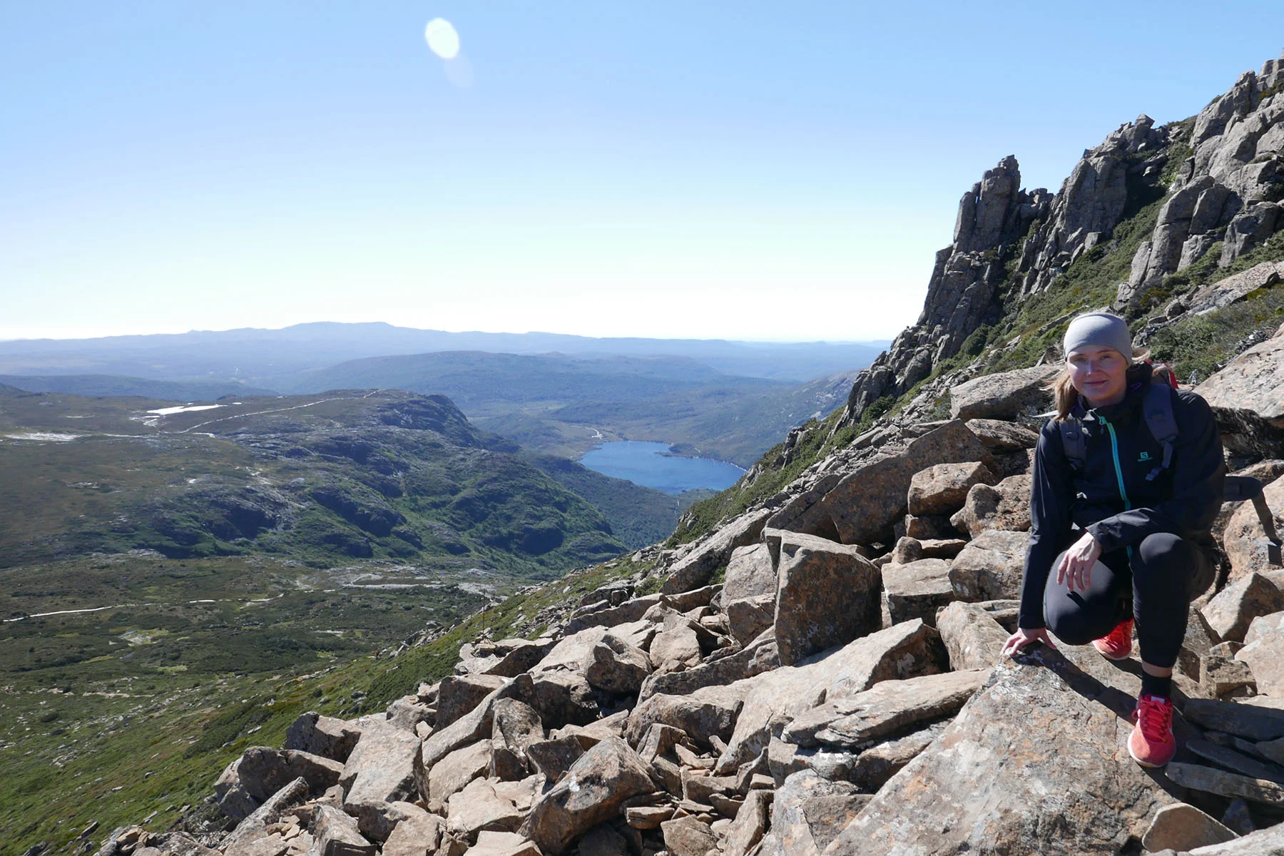
Views to Dove Lake (right) and Lake Wilks (left)
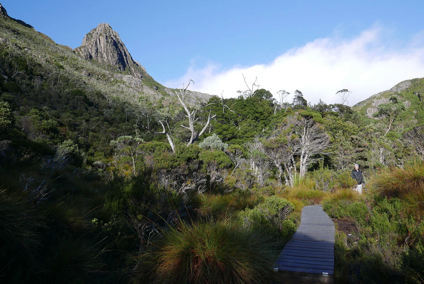
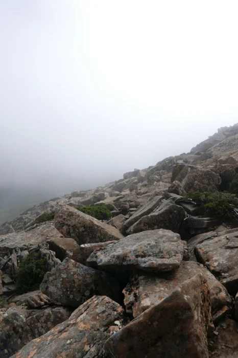
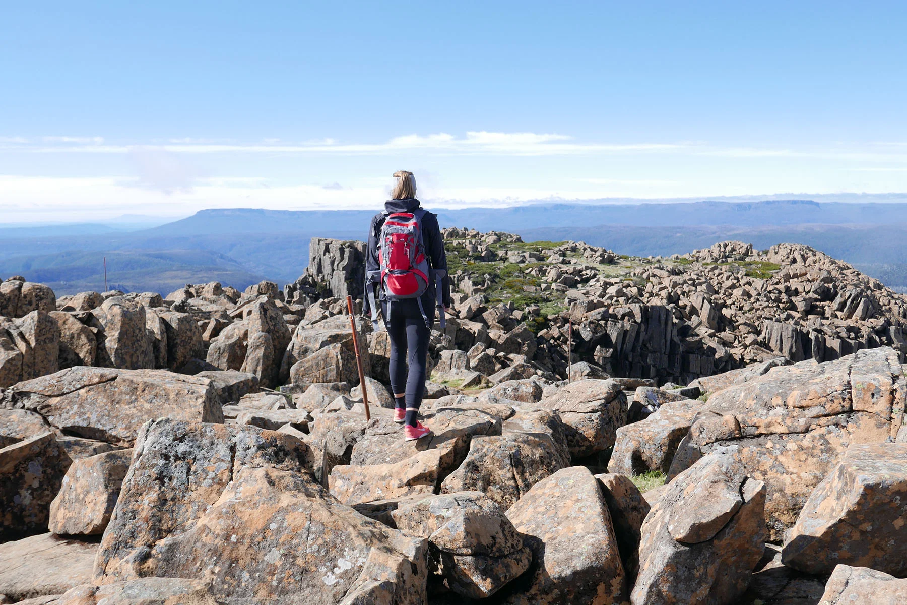
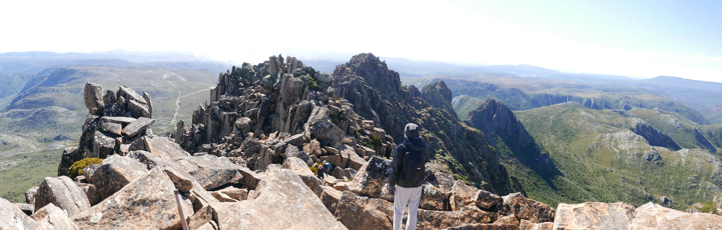
The Summit part itself begins once you've already climbed quite a bit. Signs says 2,5 hours return, you look at the mountain and think "we'll that's fairly close, shouldn't take that long". Wrong. The description of this walk at the Parks site does warn about blouder climbing but you don't quite realise the seriousness until you start that part which lasts for a long long time. We met a lot of people who had turned back saying it's too hard. Once we reached the main krux I wasn't surprised why because it did require some creative positioning of your feet, hands and body to get past some hairy spots you would not want to fall from.
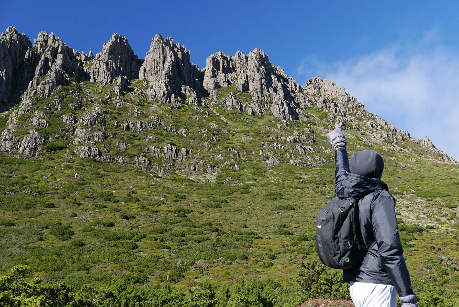
Final boulder route to the top in the horizon
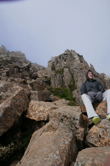
Couple tips for anyone trying to climb the summit: Bring gloves and leave big backbags at the starting point! You won't be able to fit through some of the pathways between the big rocks with even a regular size bag.
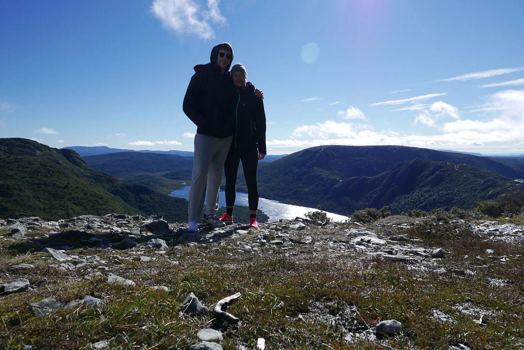
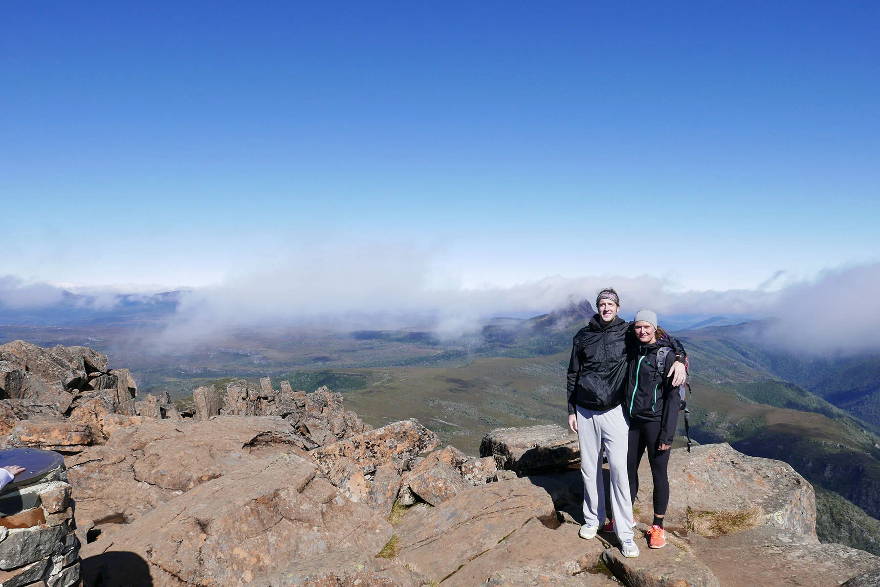
After you reach the top you thought was the summit you'll realize there's still another 30 minutes to go. But as the clouds disappeared and the cold wind didn't reach the other side we didn't care as the views started to show what rewards wait at the top.
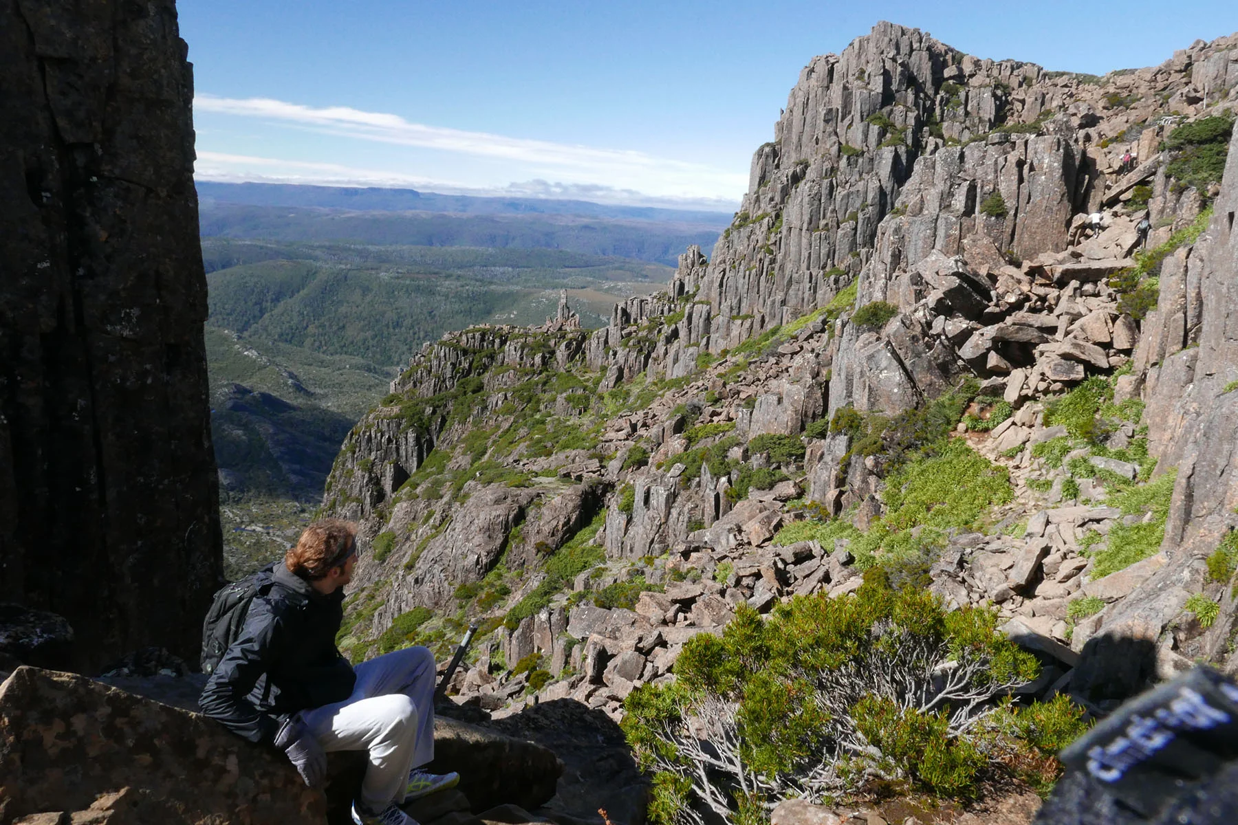
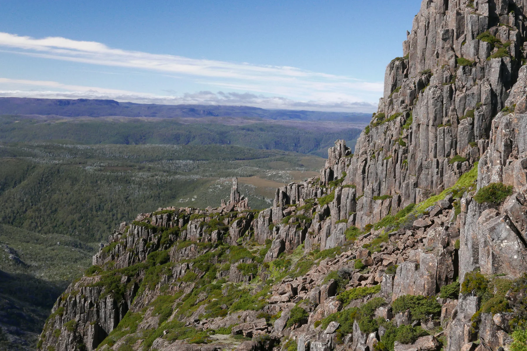
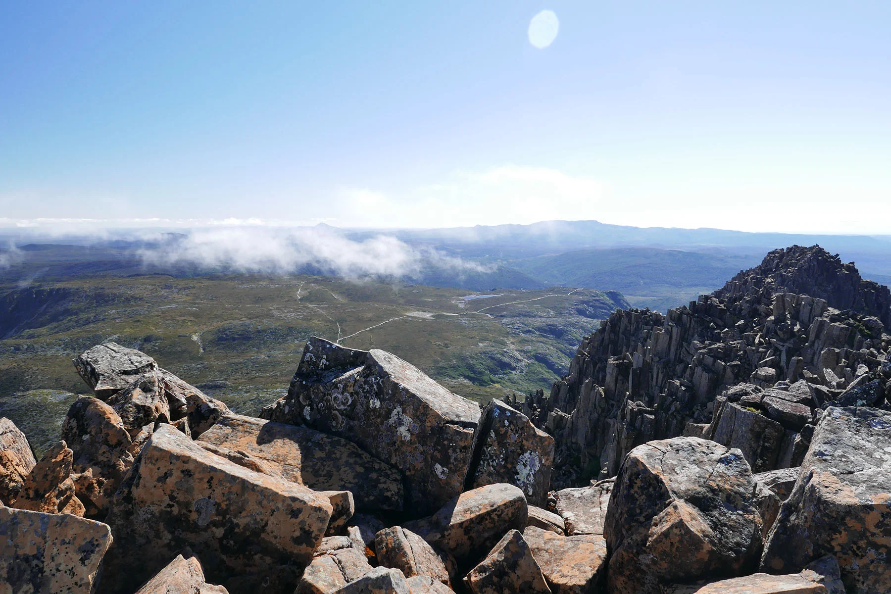
And once we reached the top, the clouds parted! We got the rare 15 minutes of clear skies, people coming after us faced only white fog all around and missed out on their scenery photos.

After a lunch break and last tea sips we started the journey back. When pulling myself up on the rocks on our way up I was very concerned about coming down the same problematic narrow pathways but the way down was way quicker. You are on your butt almost the whole time, sliding down rocks (unless you are related to a mountain goat and jump from a rock to another as some people did) and you cover a lot of distance in a short amount of time.
In summary I would highly recommend this walk if you are prepared for a challenge and some climbing. It's very doable and don't be scared off by people turning back - they just didn't try hard enough ;)
And if you love this scenery I'd recommend next stop to be Finnish Lapland - just don't go in May or June and you won't be eaten alive by the vicious Northern mosquitos.